
Pangpema Peak: Kanchenjunga North Base Camp Trek is a great trekking region in Nepal. The mountain is also often referred to as the “queen of mountains.” The Kanchenjunga region trek will undoubtedly astonish you with its undiscovered and rustic beauty, especially if you have always yearned to see Nepal’s off-beat places. The area has a variety of natural zones, from glacier wildness to subtropical areas. However, the impressive Kanchenjunga glacier is this region’s major draw.
Kanchenjunga base camp trekking isn’t quite frequently visited by foreign travelers and is wrapped in mystery with extremely difficult mountain trails and lush rhododendron woods. Aside from stunning snow-capped mountain peaks, the Kanchenjunga North Base Camp treks also provide panoramas of subtropical lowlands, rhododendron and alpine forests, and breathtaking glaciers. Due to the difficulty of the trip, it is advised that only individuals with previous trekking experience and excellent physical fitness levels attempt it.
The actual north face base camp is located at Pangpema (5,100), which is reached by a steep trail that follows the Kanchenjunga Glacier’s moraine. The base camp, which is situated above the glacier, provides breathtaking views of Yalung Kang, also known as Kanchenjunga West (8,505m), and the north face of Kanchenjunga. To build up endurance for the return trip and enjoy the jaw-dropping views of Mount Kanchenjunga, Janu Himal, and other Himalayan peaks, an additional day is spent here.
Mt Kanchenjunga is 8,586 meters high and was formerly believed to be the highest peak in the world until 1849; it is the third tallest mountain in the world, trailing only K2 (8,611 meters) and Mount Everest (8,848 meters).
Table of Contents
BIRDS AND ANIMALS FOUND IN THIS REGION
A diversity of species, including the elusive snow leopard, the Asian black bear, and the red panda, are just a few of the more uncommon animals that can be found in the region, which is protected by the Kanchenjunga Conservation Area and the Sacred Himalayan Landscape program of the World species Fund.
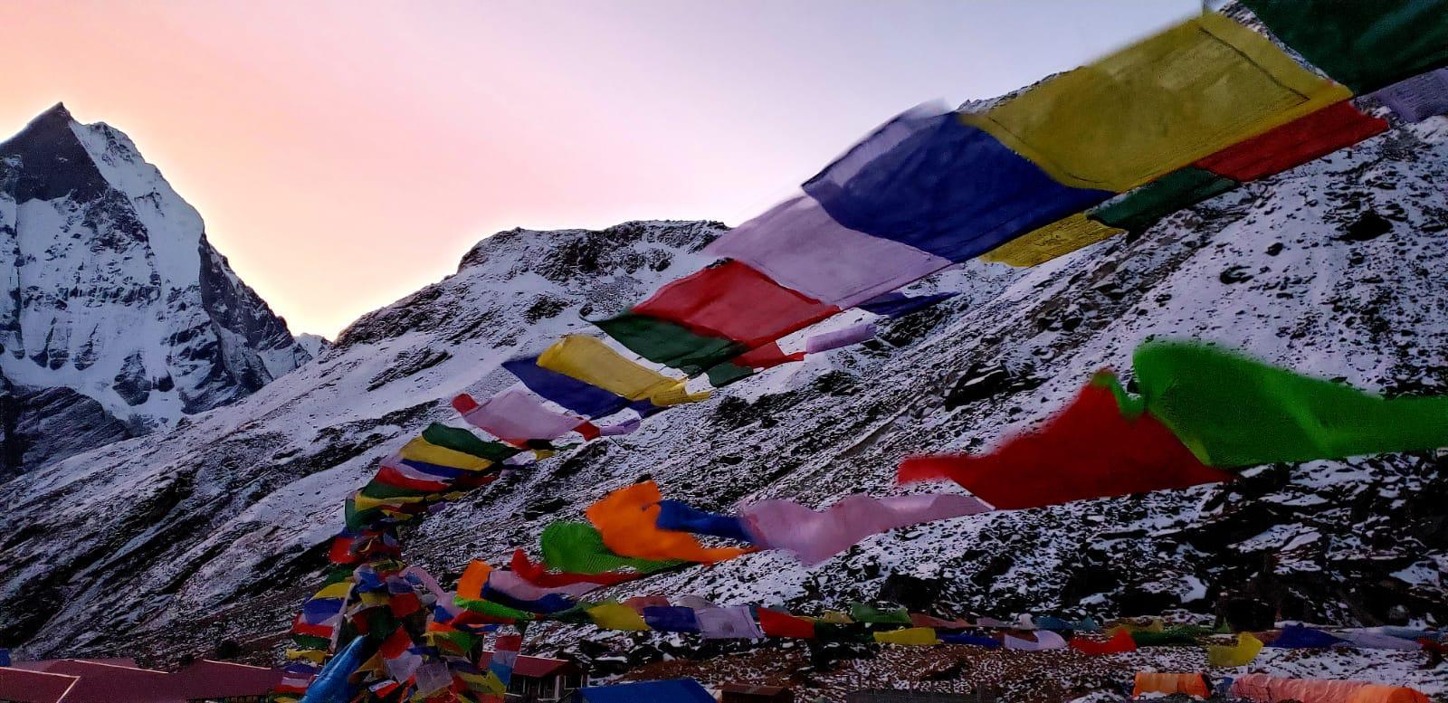
Birdwatchers may have the opportunity to witness species, including the blood pheasant, snow cock, and golden-breasted fulvetta. The Tibetan Buddhist villages, monasteries, and prayer flags provide a distinctive character to the walk because they are located in the farthest eastern part of Nepal and border Sikkim in India and Tibet.
KANCHENJUNGA TREK HIGHLIGHTS

- Experience the trek to the third-highest peak in the world’s lap through regions that aren’t often visited.
- Exceptional views of the Makalu range, the Kanchenjunga massif, and surrounding peaks, including Jannu, Mera, the Twins, and Wedge (Chang Himal).
- cultures of the high mountains untouched by modernization
- Wander through high-altitude marshes and alpine meadows.
- Follow the Tamur and Ghunsa Rivers’ glacier torrents.
- Trek through the remote settlements of the Kirat and Sherpa tribes.
- peaceful exploration of the stunning mountain wilderness
- View of the majestic Kanchenjunga mountains to the north from Pangpema base camp.
- Difficult passes and high-altitude terrain.
- A wide range of flora and fauna
HOW TO GET KANCHENJUNGA TREK PERMIT?
You must obtain two permissions for the Kanchenjunga Trek: the Restricted Area Permit (RAP) and the Kanchenjunga Conservation Area Project (KCAP) permit. Trekkers can get their KCAP from the Nepal Tourism Board in Kathmandu, but they can only get their RAP through a legitimate Nepali trekking agency on their behalf.
The second-highest mountain in Nepal and the third-highest mountain in the world, Mt. Kanchenjunga, could be seen up close on the Kanchenjunga trip. It still maintains its status as a restricted region despite having been made accessible to trekkers in the late 1980s. The ideal trekking area is off-the-beaten-path since it is still secluded and offers the most extraordinary and stunning unspoiled environment.
PERMIT FEE
1. Kanchenjunga Restricted Area Permit
During the Kanchenjunga trek, trekkers need a Restricted Area Permit (RAP) to visit these areas. Given that the area near the boundary between India and Tibet has been given a restricted designation. This aids in regulating tourists, safeguarding wildlife, and putting a stop to any unlawful activity in the region.
A government-registered and authorized Nepali trekking agency is the only entity permitted to apply for and get this permission on your behalf. The cost of the Kanchenjunga RAP varies on how long you spend on the trek in the restricted area. Please take note that the prices shown below apply to both foreigners and SAARC nationals.
Restricted Area Permit Cost
$20 per person per week for the first four weeks.
$25 per person per week beyond the first four weeks.
2. Kanchenjunga Conservation Area Project
The 2,035 sq. km. Kanchenjunga region is protected and developed as a result of the Kanchenjunga Conservation Area Project (KCAP) authorization. This permit has no expiration date.
Kanchenjunga Conservation Area Project Permit
Citizens of Nepal are charged NPR 100 per person.
The cost for SAARC citizens is NPR 500 per person (about $5).
The cost for foreign nationals is NPR 2000 per person (about $20).
PAPERWORK REQUIRED TO OBTAIN A TREKKING PERMIT
During the application procedure, you will need to present the following paperwork to get a Kanchenjunga Trek permit:
- Two photographs the size of a passport (for KCAP)
- A scanned or electronic copy of a passport-size photo must be posted on the Kanchenjunga RAP website.
- a copy of your current passport
- Travel insurance documents (including emergency helicopter transport)
- The passport must still be valid for at least six months.
- Having a Nepal tourist visa that is valid after the RAP’s expiration date
- Other paperwork required by the trekking company to apply for the Kanchenjunga RAP includes trekker and guide group information, guarantee letters, itinerary confirmations, tax clearance certificates, and business licenses.
While all of the above paperwork can seem too much, it will be simpler for your trekking agency will follow up on the necessary paperwork from your end and offer the remaining paperwork on their own.
WHERE TO OBTAIN KANCHENJUNGA TREK
Permit for the Kanchenjunga Conservation Area
The permit can be obtained by trekkers. To apply, go to the Tourism Board in Bhrikutimandap, Kathmandu, which is open on Saturday and Sunday from 9 am to 5 pm, excluding public holidays. You’ll need around an hour to obtain the permission.
Permit for Kanchenjunga Restricted Area
This permit cannot be acquired by trekkers; rather, a legitimate Nepali trekking organization must do it. After you arrive in Kathmandu, they will submit an online application for this permission with all the paperwork you provided and any additional paperwork they created. They will next pick up the permission at the Maitighar, Kathmandu-based office of Nepal Immigration’s Trekking Department.
With the assistance of a reputable, experienced Nepal trekking company, the two permits for the Kanchenjunga Trek may be simply secured. You may get in contact with Treks Planner Nepal to plan and arrange your trip and to assist you in comprehending the permission needs. Our team of professionals will make sure that you quickly and simply get the permissions. Travel to the isolated and lush Kanchenjunga area without any hassles.
KANCHENJUNGA TREK ITINERARY:
Day 1: Arrival in Kathmandu
30 Min Drive to Hotel
Max Altitude: 1350 M

Day 2: Trip preparation
Full Day

Day 3: Fly to Bhadrapur from Kathmandu & Drive to Taplejung
40 Minutes Flight & 8/9 Hours Drive
Max Altitude: 2000 M

Day 4: Trek to Chiruwa
7/8 Hours Walk
Max Altitude: 1290 M

Day 5: Trek to Sermanthang
6/7 Hours Walk
Max Altitude: 2150 M

Day 6: Trek to Amjilosa
5/6Hours Walk
Max Altitude: 2803 M

Day 7: Trek to Gyabla – Ghunsa
8/9 Hours Walk
Max Altitude: 3550 M

Day 8: Acclimatization day in Ghunsa
Full Day
Max Altitude: 3550 M

Day 9: Trek to Khambachen
5/6 Hours Walk
Max Altitude: 4000 M

Day 10: Acclimatization Day - Optional Side Trip to Janu/Kumbakarna Base Camp)
Full Day
Max Altitude: 4000 M

Day 11: Trek to Lhonak
5 Hours Walk
Max Altitude: 4770 M

Day 12: Trek from Lhonak – Pangpema (North B.C.) – Lhonak
7/8 Hours Walk
Max Altitude: 5143 M BC

Day 13: Trek to Khambachen
5 Hours Walk
Max Altitude: 4000 M

Day 14: Trek to Ghunsa – Further to Phaley
5/6 Hours Walk
Max Altitude: 2900 M

Day 15: Trek to Amjilosa
5 Hours Walk
Max Altitude: 2308 M

Day 16: Trek to Ranipul
3/4 Hours Walk
Max Altitude: 1800 M

Day 17: Drive to Taplejung
6/7 Hours Drive
Max Altitude: 2000 M

Day 18: Drive to Bhadrapur
 8/9 Hours Drive
Max Altitude: 91 M

Day 19: Fly to Kathmandu from Bhadrapur & Transfer to hotel
40 Minutes Flight & Transfer to Hotel
Max Altitude: 1350 M

Day 20: Departure from Kathmandu
30 Min Drive to Airport
FEEL FREE TO REACH OUT!
- Manaslu Circuit Tsum Valley vs Manaslu Circuit 2027: Which Trek Should You Choose?
- Private vs Group Manaslu Circuit Trek: Which Option Is Best for You?
- Manaslu Circuit Trek Cost Breakdown (Updated for 2026/2027)
- Female Trekking in Nepal: The Complete Guide for Solo and Women Travelers 2026
- Nar Phu Valley Trek Guide 2026: Everything You Need to Know Before You Go