Nar Phu valley trek

Last Updated on March 12, 2019 by Treks Planner Nepal

nar phu valley

Introduction of Nar Phu valley

Nar and Phu are two adjoined village development committees, geographically tucked on remote region of Manang district in Gandaki zone at close elevation around (4,150 m/ 13,615 ft) up above sea level. As the matter of fact, Nar accompanied by not more than 86 house roofs, with 362 people and Phu accompanied by not more than 36 house roofs, with 176 people, only speaks a secret language known as Sino-Tibetan in Nepal. Beyond everything, pinpointed between Annapurna and Manaslu regions, Nar and Phu are ideal destinations to explore unspoiled valleys, featuring raw Himalayan nature with ancient Buddhist culture.

Attractions of Nar Phu valley trek

  • Opportunity to trek an extremely remote domain which was recently opened back on 2002 AD.
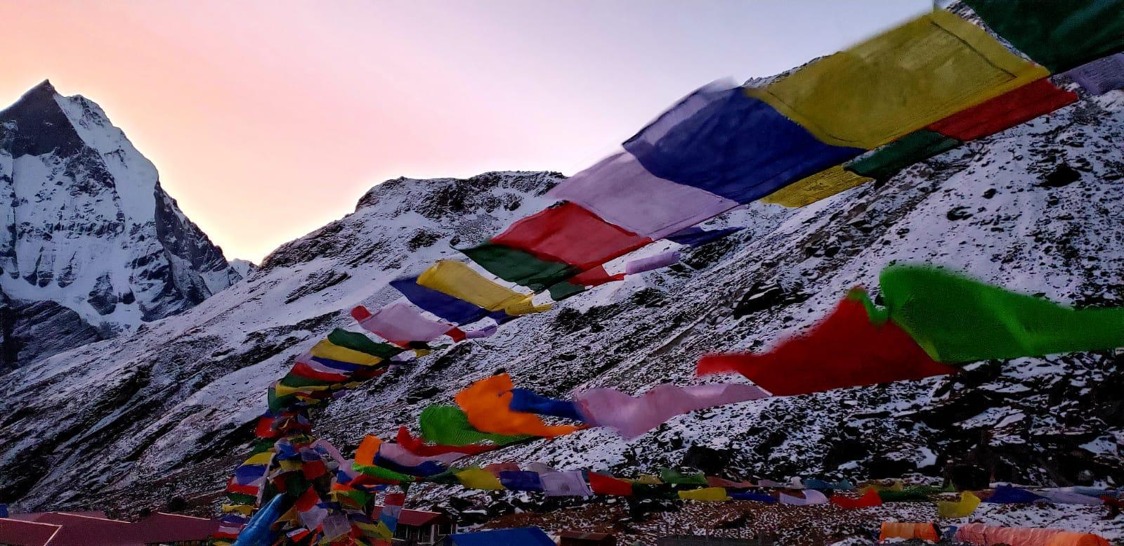
  • Magnificent and breathtaking glimpse of peaks including Annapurna II, Gangapurna, Manaslu, Tilicho with Dhaulagiri range, Lamjung Himal and Nilgiri as well.
  • Experience of walking via high pass (Kang La Pass) at an elevation of (5,322 m/ 17,460 ft) with unbelievable clear glimpse of Crystal Mountains.
  • Perfect chance to analysis raw nature, unspoiled valleys and isolated language known as Sino-Tibetan at a same time.
3

Itinerary for Nar Phu valley trek

Day 01: Arrival day (1,300m/4,264 ft)
Day 02: Drive to Besisahar (760m/2,493ft) 7 hours
Day 03: Trek to Bahundanda (1,398m/45,86ft) 6 and half hours
Day 04: Trek from Bhaudanda to Chamje (1,410m/4,625ft) 5-6 hours
Day 05: Trek from Chamje to Bagarchhap(2,080m/6,824ft) 6-7 hours
Day 06: Trek from Bagarchap to Koto (2,720m/8,923ft) 5-6 hours
Day 07: Trek from Koto to Meta (3,560m/11,680ft) 7-8 hours
Day 08: Trek from Meta to Phu Gaun (4,250m/13,944ft) 7-8 hours
Day 09: Acclimatization day at Phu Gaon (4,250m/13,944ft
Day 10: Trek from Phu to Nar (4,110m/13,484ft) 6-7 hours
Day 11: Acclimatization at Nar (4,110m/13,484ft)
Day 12: Trek from Nar to Kang La Pass (5,322m/17,460ft) to Ngwal (3,660m/ 12,008ft) 7-8 hours
Day 13: Trek from Ngawal to Chame (2,670m/8,759ft) 5-6 hours
Day 14: Trek from Chame to Tal (1,700m/5,577ft) 7 hours
Day 15: Trek from Tal to Besisahar (760m/2,493ft) 8 hours
Day 16: Drive from Besisahar to Kathmandu (1,300m/4,264ft7) 8 hours
Day 17: Departure day (1,300m/4,264ft

Check Nar Phu Valley Trekking Package

Best season to trek Nar Phu valley

Months during autumn (September to November) and months during spring (March to May) are considered as the best seasons for trekking to Nar Phu valley. Around this time, clear climate and brilliant perspectives of the mountain in the Manang district is ensured. Certain trekkers desiring to avoid the crowd and waiting heavy snow can trek during winter (December to February) but you must be ready to face a chilly cold which can bother you. Monsoon season during (June to August) will be influenced by rain and the trekking paths are really hazardous and slippery so avoiding monsoon is smart decision.

Necessities and requirements to trek Nar Phu valley

Documents and pay: Passport, separate photocopies of passport, proof of insurance, 2 extra pp size photos, airline tickets, card money, ready money for purchasing Nepalese visa at Airport and (for withdrawing funds bank/ATM) photocopies of identity card.

Body wear: Head scarf, hat/cap, head lamp with alternative batteries, sunglasses, gloves, wind cheater jackets, waterproof jacket, half and long sleeves upper wears and light and warm upper wears, Inner wears, trekking shorts, trekking trousers, warm trousers, waterproof pants, light weighted thermal bottoms, socks and trekking shoes.

Practical items: Sleeping bag, large travel bag, compact personal carry bag, camera with extra batteries, binoculars, mini folding knife, anti-bacteria hand wash, guide books, pocket travel games, power bank.

Medical and toiletries: First aid box (especially including band aids, anti-loose motion pills, anti headache pills, cold and cough medicine, anti-altitude sickness pills, water purification tablets, stomach antibiotic) and toiletries info’s according to your preference.

Besides, these are the vital requirements apart discussing about requirements with trekking agency before can more establish your trip easy and straightforward.

Check Nar Phu Valley Trekking Package

Nar Phu valley trek difficulty level

In fact, Nar Phu trekking route crawls throughout 4,000 m – 4,500 m above sea level so it is considered as simple in light of the fact, the trail is considered as the simple chain alongside with adequate height and just basic battles. Additionally, this trail requests respectably fit trekkers having awesome highland passion in addition trekkers must be genuinely dynamic, take after solid way of life and prepare frequently no less than couple of months earlier the trail to develop stamina and continuance limit. Cycling, extreme climbing, outside, Muscles expanding, incredible activities sets ups can develop required quality for trekking Nar Phu valley.

Check Nar Phu Valley Trekking Package

Best package for Nar Phu valley trek

Several of packages are outlined by travel associations considering various terms and conditions. Still, none of the packages are permanent, customizing package and preparing as per individual inclination is splendid choice for seizing perfect package. Thereupon, a few packages are designed with short period and some appear to be expanded. Be that as it may, trekker holding less time for trek can seize short period package and trekkers holding enough time further can pick up according to their preference and desire.

Check Nar Phu Valley Trekking Package

Trekking with us

Security and welfare: Supreme reasons expressed by most of the trekkers after associating with us is extremely rewarding trip with safe take off with great welfare. In addition, dangers and unsafe are profoundly prohibited with high security.

Guide: In fact, there are innumerable venues hidden in transit which most of the time offers breathtaking corners. Thus, missing those destinations is completely dismissed after associating with us.

Information: Contribution of guide (characteristics holding an excellent knowledge about throughout with fluent speaking capacity of many languages) for establishing up trip more magnificent and marvelous.

Contact Us

Top 10 Nepal Mountains|Top 10 peaks of Nepal

Last Updated on January 2, 2019 by Treks Planner Nepal

Top 10 peaks of Nepal | Top 10 Nepal Mountains

In actual fact, Nepal is landlocked by India on the south and east moreover China on the west and north while Nepal has tremendous topographical diversity and presents amazing geographical highlights in the width of just 230 kilometers from North to South.  On aggregate land area of 147,181 km2, Himalayan territory possesses just 9% of aggregate land despite holds in excess of over 80 peaks all through including the highest peak of the globe.

Beyond everything, let’s have a look after top 10 peaks of Nepal:

Mt. Everest (8,848 m/ 29,035 ft)

Mount Everest holding official height of 8,848 m/ 29,035 ft is identified as the highest peak of the world which pinpoints in Solukhumbu district of Khumbu Mahalangur Himalayan range.  Gigantic peak estimated to be more than 60 million years back is itself popular with its official English name -“Mount Everest” throughout the world but Nepalese people utters as Sagarmatha which means the goddess of sky likewise Tibetan people utters as Chomolungma which means the goddess of the universe. As a matter of fact, a New Zealand mountaineer- Sir Edmund Hillary and Tenzing Norgay Sherpa were the first to climb Mount Everest successfully in 1953.

Kanchenjunga (8,586 m/ 28,169 ft)

Kanchenjunga holding official height of 8,586 m/ 28,169 ft is identified as the third highest peak of the world which pinpoints in Taplejung district of northern Kanchenjunga range. 125 kilometers far away towards south-east of Mount Everest the mammoth peak “Kanchenjunga” is named from Tibet at the early age. Kanchenjunga massif consists of five major peaks while these five peaks are also called ‘the five treasures of the snow’ likewise five treasures are considered  as salt, gold, turquoise, sacred scriptures, invincible armor and medicine. As a matter of fact, Joe Brown and Gorge Band were the first to climb Kanchenjunga successfully on 25th May, 1995.  

Lhotse (8,516 m/ 27940 ft)

Lhotse holding official height of 8,516 m/ 27,940 ft is identified as the fourth highest peak of the world which pinpoints in Khumbu region of northern Mahalangur Himalayan range. Lhotse Face is often described as ‘a wall of glacial blue ice’. It is comprised of three prominent peaks- the main summit, the Lhotse East and the Lhotse Shar. As a matter of fact, Ernst Reiss and Fritz Luchsinger were the first to climb main summit successfully in 1956 likewise Eugeny Vinogradsky, Sergei Timofeev, Alexei Bolotov and Petr Kuznetsov were first to climb Lhotse East successfully in 2001 and Sepp Mayerl and Rolf Walter were first to climb Lhotse Shar successfully in 1970.

Mt. Makalu (8,481 m/ 27,825 ft)

Mt. Makalu (Isolated peak) holding official height of 8,481 m/ 27,825 ft is identified as the fifth highest peak of the world which pinpoints in Khumbu region of Makalu Mahalangur Himalayan range. Actually, the word “Mt. Makalu” is derived from the Sanskrit word “Maha Kala” which means “Big Black” and an isolated peak that lies 14 miles (22 kilometers) southeast of Mount Everest also resembles like a four-sided pyramid of snow and ice. As a matter of fact, Lionel Terray and Jean Couzy were the first to climb Mt. Makalu successfully in May 15, 1955.

Mt. Cho Oyu (8,188 m/ 26,864)

Mt. Cho Oyu holding official height of 8,188 m/ 26,864 ft is identified as the sixth highest peak of the world which pinpoints in Khumbu region of Makalu Mahalangur Himalayan range. 20 kilometers west of Mount Everest named Mt. Cho Oyu peak holds Tibetan origins and the word ‘Cho Oyu’ means ‘Turquoise Goddess’. Another rendition of the name also suggests the mountain’s nomenclature is derived from a Tibetan word that means “the Bald God”. As a matter of fact, Jochler, Herbert Tichy and Sherpa Pasang Dawa Lama were first to climb Mt. Cho Oyu sucessfully in October 19th, 1954.

Dhaulagiri I (8,167 m/ 26,795 ft)

Dhaulagiri I holding official height of 8,167 m/ 26,795 ft is identified as the seventh highest peak of the world which pinpoints in Annapurna region of Dhaulagiri Himalayan range. Massively extended from the Kali Gandaki River all the way to Bheri name of peak was formed from two differ Sanskrit words “Dhaula” and “Giri” where “Dhaula” means “Dazzling, white and beautuful” and “Giri” means “Mountain”. Dhaulagiri I also plays role to form world’s deepest gorge- the Kali Gandaki Gorge. As a matter of fact, Kurt Diemberger, A. Schelbert, E. Forrer, Nawang Dorjr and Nyima Dorje were the first to climb Dhaulagiri I in May 13th, 1960.

Mt. Manaslu (8,156 m/ 26,759 ft)

Mt. Manaslu holding official height of 8,156 m/ 26,759 ft is identified as the eighth highest peak of the world which pinpoints in Gorkha district of Mansiri Himalayan range. The word “Manaslu” came from the Sanskrit word “manasa” which means “intellect” or “soul” likewise identified as “Kutang” in Tibet which means “the Mountain of Spirits”. Likely, Mt. Manaslu is also famously regarded as “a wall of snow and ice hanging in the sky”. As a matter of fact, Toshio Imanishi, Artur Hajzer and Gyalzen Norbu were the first to climb Mt Manaslu sucessfully in 1956.

Annapurna I (8,091 m/ 26, 545 ft)

Annapurna I holding official height of 8,091 m/ 26,545 ft is identified as the tenth highest peak of the world which pinpoints in Annapurna region of Annapurna mountain massif. In fact, Annapurna was derived from Sanskrit which means “Full of Food” likewise ideal peak is also associated with Hindu goddess and considers as “the Goddess of Good fortune and wealth”. As a matter of fact, Maurice Herzog, Louis Lachenal, Lionel Terray were the first to climb Annapurna I sucessfully on 3 June 1950.

Gyachung Kang (7,957 m/ 26,206 ft)

Gyachung Kang holding official height of 7,957 m/ 26,206 ft is identified as the fifteenth highest peak of the world that lies between Mount Everest and Mount Cho Oyu which pinpoints in Khumbu region of Mahalangur Himalayan Range. The vigorously glaciated peak of Gyachung Kang is very quiet and the mountain resembles a smooth baldachin that sights like it’s covering secrets underneath….As a matter of fact, Yukihiki Kato, Kiyoto Sakaizawa and Pasang Phutar were first to climb Gyachung Kang sucessfully in April 10, 1964.

Annapurna II (7,937 m/ 26,040 ft)

Annapurna II holding official height of 7,937 m/ 26,040 ft is identified as the sixteenth highest peak of the world which pinpoints in Annapurna region of Annapurna mountain massif. Additionally, Annapurna peak is also listed on second position of Annapurna Himalayan range. In fact, Annapurna was derived from Sanskrit which means “Full of Food” likewise ideal peak is also associated with Hindu goddess and considers as “the Goddess of Good fortune and wealth”. Combined British/Indian/ Nepali expedition team was the first to climb Annapurna II successfully in May 17th, 1960.

Feel Free To Contact us