
Climbing Ama Dablam and Lobuche Peak: Two 6000ers Peak. The Lobuche Mountain consists of two distinct summits, East and West, which are 6,119 and 6,145 meters high, respectively. Even though a continuous ridge runs between them, there is still a noticeable space and a sharp separation. While the West mountain is referred to as an Expedition Peak, the East Peak is designated as a trekking peak. Being a beautiful mountain, Lobuche provides various established routes and the possibility of new ones. The south ridge is formed by the black triangle of its stony east face, which rises over the Khumbu Glacier’s mountains to a breathtaking skyline.
Nestled in the Himalayan range in Eastern Nepal, Ama Dablam—also called the “Matterhorn of the Himalaya”—is one of the world’s most breathtaking mountains. Ama Dablam distinguishes itself by having a distinct pyramid form. The name “Ama Dablam” comes from the hanging glacier on the southwest face of Ama Dablam, which resembles the holy adornment box used by Sherpa women and is called Dablam. This mountain is elevated 6,812 meters above sea level. This mountain is remarkable not because of its height but because of its beauty. Situated south of Mount Everest in Nepal’s Khumbu area lies Mt. Ama Dablam. While climbing to the summit, one should be treated to some breathtaking vistas.
LOBUCHE PEAK HIGHLIGHTS:
- Reach the 6,119-meter-high summit of Lobuche East Peak.
- Catch a glimpse of the magnificent Himalayan landscape from the summit.
- Heavenly vistas of Mt. Everest, Mt. Lhotse, Mt. Makalu, Mt. Nuptse, Mt. Amadablam, Mt.
- Pumori, and several more peaks will leave you utterly delighted.
- Go close to Khumbu Glacier, the tallest glacier in the world.
- Walk the renowned Everest Base Camp Trek route to Lobuche.
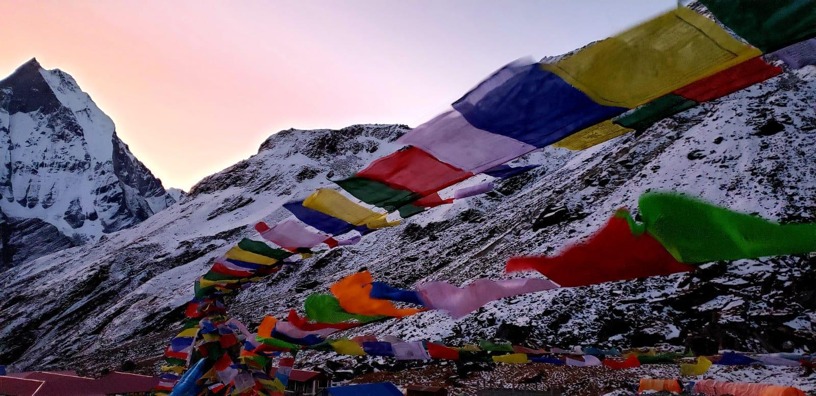
- Discover the culture and distinctively formed Sherpa villages.
- Walk through deep woods, past prayer flags, gompas, and monasteries, and over
- suspension bridges.
AMA DABLAM HIGHLIGHTS
- Lobuche East (6119M) and Ama Dablam 6812M (Acclimatization training peak)
- Route around the south-west ridge, Camps 1–2 (maybe Camps 2.9 or 3)
- Ten days in the 4570-meter-high Ama Dablam Base Camp
- The expedition’s guide-to-climber ratio is one-to-one.
- Beautiful Khumbu Valley Trek
MOUNTAIN GRADING
Lobuche Peak Grading (ALPINE/FITNESS): PD+ / 3.
Ama Dablam Grading (ALPINE/FITNESS): TD / 5.
As our training and acclimatization peak before we head to Ama Dablam Base Camp, we will be climbing Lobuche East.
LOBUCHE PEAK TECHNICALITY
The rated PD alpine peak Lobuche East (6119 meters) features extensive glaciers and some tricky climbing. Climbers participating in this expedition should have some basic mountaineering expertise, such as rock scrambling and using crampons and ice axes to climb on snow or ice. It is ideal if you have taken basic winter or alpine courses, where you are fully versed in the fundamental technical aspects of alpine climbing. Although it is primarily meant to serve as a skill refresher, the trip will include a day of basic skill instruction.
AMA DABLAM CLIMBING TECHNIQUES
We will set up two to three camps and ascend along the southwest ridge, which is the safest path, during the Ama Dablam trek. Following our setup at Base Camp, we will ascend the moraine to reach Camp 1 (5,807 meters/19,052 feet). To get from Camp 1 to Camp 2, fixed-line ropes are used for climbing over snow-covered, rocky, exposed ridges, and vertical granite as well as for traversing solid granite. It takes 60 to 70 feet of vertical rock climbing to reach Camp 2 (6,200 meters/20,594 feet), also called the “YELLOW TOWER.” This is the beginning of the most challenging and demonstrably risky section of the climb.
CAMP 1 (5800M) AND CAMP 2 (6100M) OF BASE CAMP (4529M) ROTATION
We will review our climbing techniques and conduct a few acclimatization rotations from Days 12 to 19–20 to fully acclimate the body for the final summit push. We will transport and keep our personal belongings at our camps during these cycles.
Although the slope on Ama Dablam is not as severe as one might imagine, the route’s extreme exposure makes for interesting climbing. This route is suitable for climbers with an intermediate level of technical skill. On the summit day, the path goes straight to the 6,810-meter peak by a snow arête that passes between ice cliffs. But the ascent is strenuous on the body and takes a lot of climbing time on the summit day.
CAMP 2.1 And 3 (6400M) (SITUATIONAL) AND SUMMIT BID
We shall assess the serac’s safety and conditions before determining whether to establish camp 3. We will try our summit from Camp 2, beginning in the early hours, if our lead Sherpa finds that the campsite is risky. (at midnight or one in the morning)
When conditions are clear, Ama Dablam’s wide peak provides stunning vistas. From the summit of Ama Dablam, one can see other 8000- and 7000-meter peaks, such as Makalu (8463 meters) and the Baruntse range (7170 meters).
Before considering Ama Dablam, one needs to train in the techniques of rock and ice climbing and acclimate to high altitudes. The Ama Dablam Expedition is for you if you have climbing expertise and want to go with a group to the most amazing peak in the world.
AMA DABLAM EXPEDITION COST AND SERVICE INCLUDE
The cost of the Ama Dablam and Lobuch Peak expedition (please click here for pricing). Our team offers excellent, comprehensive services that include one-on-one climbing assistance, experts from the area who impart their cultural and traditional knowledge, an emphasis on safety, a successful summit plan, and excellent base camp support. For climbers to have the best possible climbing experience, our staff is committed to operating as a responsible, upright, and sustainable mountain adventure company.
COST INCLUDES:
- Airport Pick-Up & Drop Services
- Accommodations & Meals:(All twin sharing basis)
- 1:1 Sherpa Guide /client ratio.
- Lobuche East 6019M acclimatization peak
- Flight / Transportation All domestic airfares as per the Itinerary
- Climbing/Trekking permit: All necessary Trekking permits
- National Park Fare: All necessary National Park entrance fee
- First Aid: Medical kit box during the trip
- Trekking guide during the trek and climbing Sherpa while climbing
- Required porters to carry luggage and other essential supplies
- Special climbing permits and their procedure
- Garbage deposit fees
- All wages, equipment, medical and accidental Insurance for all involved staff during the trip
- First Aid medical kits for the Group and the staff.
- Satellite phone carrying by Guide for communication with company staff and available for members with the cost of US$ 4 per minute call.
- Required fixed and dynamic rope during the climbing period.
- Gamow Bags/Oxygen
- Climbing/Trekking Equipment: Duffel Bag, T-shirt, Down jacket, and four seasonal sleeping bags (which need to be returned after the trek), Altitude Chamber: Portable Altitude Chamber on request
- Certificate: Trek Planner adventure certificate
- Others: All applicable government and local taxes as per the itinerary
ARE THERE ANY REQUIREMENTS TO CLIMB AMA DABLAM?
Lobuche East and Island Peak, Chulu West, Khumbu 3 Peak excursions, Aconcagua, Mt. Blanc (or peaks that are similar to those at elevations of 4000–6000 meters) and multi-pitch rock or ice climbing, with grades ranging from 5–9+/– to 5.10 a, b, and c.
If someone is considering climbing Ama Dablam, they should have a lot of experience with high-altitude climbing, preferably having climbed many peaks between 4000 and 6000 meters that need semi-technical to technical climbing techniques. Those who thrive on the difficulties of alpine climbing often travel to Ama Dablam. Ascending, scrambling, traversing, and descending these peaks often demand a high level of technical competence. To embark on the difficult ascent of Ama Dablam, one would need to have prior expertise in climbing similar heights.
CHOOSING THE BEST-ACCLIMATED PLAN FOR AMMA DABLAM CLIMBING
For any high-altitude climbing adventure to be successful, proper acclimatization is essential. As part of our acclimatization approach, our crew will rotate between Camps 1 and 2, according to the maxim “climb high, sleep low”. With our years of expertise, we have meticulously designed the schedule to provide your excursion with the maximum chance of success.
We will also climb Lobuche East as an acclimatization/training peak as part of the Ama Dablam climbing expedition. We will have a fully furnished base camp and two high camps (Camps 1 and 2, with a possible Camp 2.7 depending on circumstances) during the real Ama Dablam ascent.
OUTLINE ITINERARY:
Day 01: Arrival in Kathmandu (1300m) and transfer to hotel.
Day 02: Trip briefing, paperwork, checking equipment & sightseeing around Kathmandu Valley.
Day 03: Fly from Kathmandu to Lukla (2840m) and trek to Phakding (2610m) Duration: 4-5 hours.
Day 04: Trek from Phakding to Namche Bazaar (3440m) Duration 5-6 hours.
Day 05: Acclimatization Day at Namche Bazaar: (3,440m/11,284ft )
Day 06: Trek from Namche Bazaar to Tengboche (3,870m/12,694ft) Duration: 5-6 hours.
Day 07: Trek from Tengboche to Dingboche (4,360 m/14,300 ft) Duration 5-6 hours
Day 08: Acclimatization day at Dingboche and hike to Chukkung Valley (4730m) Duration: 4-5 hours.
Day 09: Trek from Dingboche to Lobuche (4930) Duration: 5-6 hours.
Day 10: Trek from Lobuche to Lobuche Base Camp (4865m/15,957 ft) Duration 3-4 hours.
Day 11: Trek from Lobuche Base Camp to Lobuche High Camp (5,600m/18,368 ft) Duration: 3-4 hours.
Day 12: Summit Lobuche Peak (6119m/20,070 ft) & back to Base Camp Duration: 7-10 hours.
Day 13: Trek from Lobuche Base Camp to Pangobche (3930 m / 12900 ft) Duration: 5-6 hours.
Day 14: Trek from Pangboche to Ama Dablam Basecamp (4,450m)
Day 15-26: Climbing period (summit Ama Dablam 6,812m)
Day 27: Trek from Ama Dablam base camp to Tengboche(3860M approx 6 hrs walk)
Day 28: Trek from Tengboche to Monju (2800m approx 07 hrs walk)
Day 29: Trek from Manju to Lukla(2840m approx 5 hrs walk)
Day 30: Extra day in case needed
Day 31: Fly from Lukla to Kathmandu
Day 32: Final Departure
