
Manaslu Circuit Trekking Guide 2025. Check out the blog if you are planning for the Manaslu circuit in 2025. The eighth-highest mountain in the world, Manaslu Mountain, lies in the Manang-Gandaki zone in Nepal’s west-central region. It is situated around 64 km east of Annapurna and has an official height of 8,163 meters (26,781 feet) above sea level. The community here strongly believes that Mt. Manaslu is home to spiritual entities and defines the peak as a spirit mountain. One of Nepal’s most isolated treks, the Manaslu Circuit Trek, is quickly becoming more popular as an ideal alternative to the Everest Base Camp and Annapurna Circuit treks. The Manaslu trek is a great choice if you’re looking for an authentic, wild, and detached trekking experience in Nepal. The stunning Budi Gandaki River Valley, which offers views of the magnificent Manaslu, Mount Himachuli, and Mount Ganesh, is the trek’s most striking aspect.
Another standout feature of the Manaslu Circuit Trek is the magnificent fusion of cultures from multiple different ethnic groups. Since the Manaslu area is located near Tibet’s border with Nepal, trekkers may observe semi-Tibetan customs, civilizations, and lifestyles. Manaslu, a combination of Hinduism and Buddhism, is the dominant religion. Apart from being closer to Tibet, Gurung is typically regarded as the dominant ethnic group in this region, and Sherpa people as a whole are heavily influenced by Buddhism.

Table of Contents
TRIP OVERVIEW
Situated just next to the stunning Annapurna range, the Manaslu Circuit Trek, which is the trekking route around Mt. Manaslu, is far more tranquil than its neighbor, the Annapurna Circuit Trek. Furthermore, due to accessibility to vehicles and roads, the initial and latter sections of the Annapurna Circuit Trek are less appealing; the Manaslu Circuit Trek is an excellent alternative. The landscape transforms from woods of rhododendrons and bamboo with white orchids to forests of spruce and fir, against which the snow and perpetual ice of the Singri Glacier and the Ganesh Himal gleam.

HIGHLIGHTS OF MANASLU CIRCUIT TREK
- One of the most stunning mountain crossings in Nepal, Larkey La (5160 m / 16751 ft), connects the Annapurna and Manaslu regions
- Trek to the newly designated, well-marked Manaslu Circuit Trek route inside the Manaslu Conservation Area, passing through areas of dense forest and unique wildlife, as well as settlements of ethnic Gurung, Magar, and Tamang people, Bhutias, and Sherpas.
- Cross the suspension bridges that are rickety, beautiful rivers, pure waterfalls, religious monuments, natural wonders, and cultural heritages.
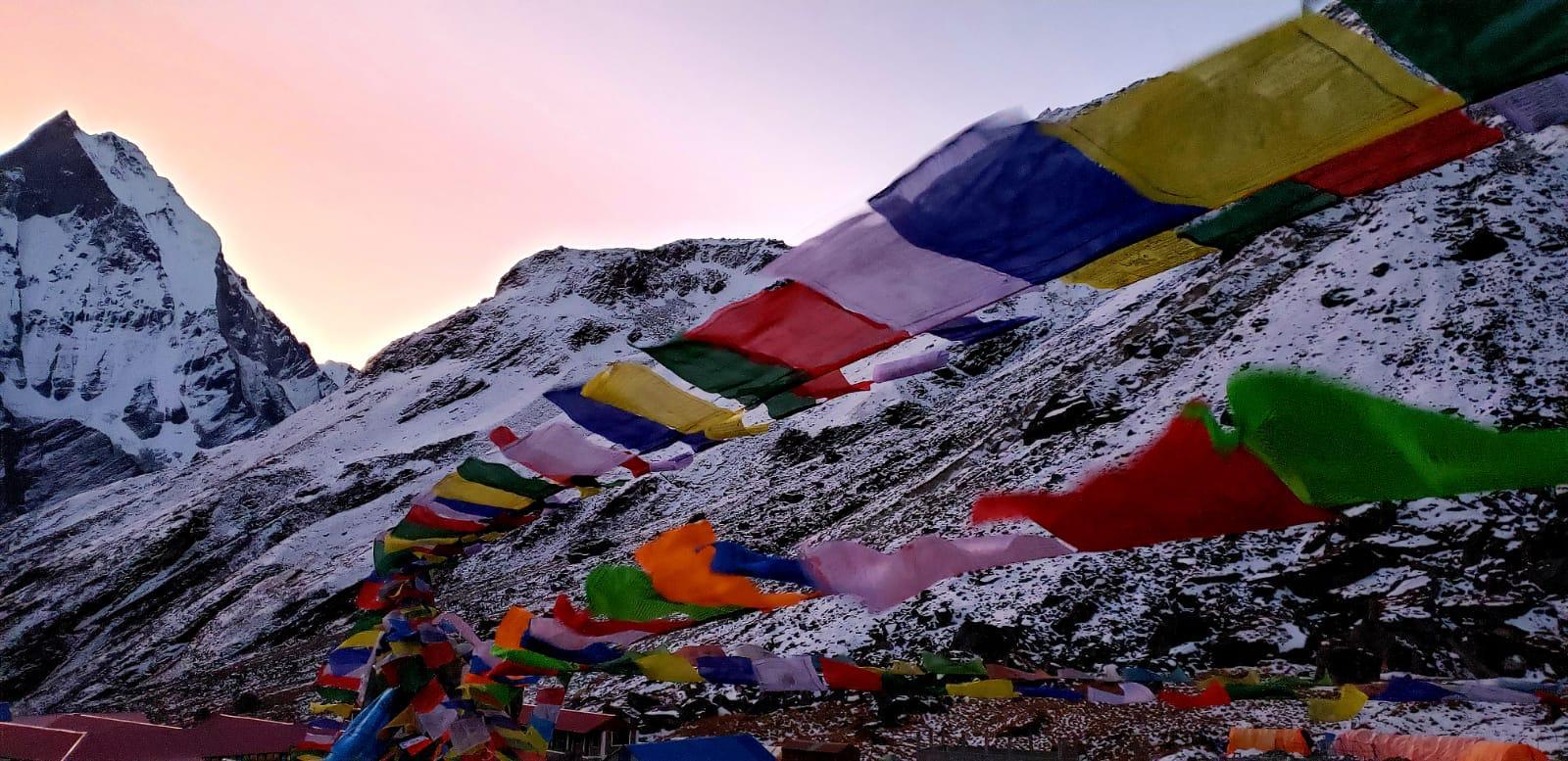
- Discover the unique Himalayan flora and fauna, Tibetan Buddhist-dominated monasteries, chortens, stupas, alleyways, long stone walls, natural caverns, pure lakes, and high alpine villages are all worth seeing.
- Witness beautiful scenery on Mt. Manaslu, Kang Guru (6981 m), Gyaji Kang (7074 m), Cheo Himal (6820 m), Himlung Himal (7126 m), Nemjung (7140 m), and Annapurna II (7,937 m). The Himalayan ecology is thriving, with lush forests mixed with a variety of terrains.
- Ideal side trips are the Birendra Lake & Manaslu Base camp to aid acclimatization or the Annapurna Circuit Trek, Tsum Valley Trek, and Nar Phu Valley Trek after completion of the Manaslu trek.
- Discover dozens of waterfalls and raging rivers including Budhi Gandaki, Soti Khola, and Machha Khola.
- Many endangered species of animals and birds, including lophoporous Red-headed Vulture Sarcogyps calvus, Satyr Tragopan Tragopan satyr, River Lapwing Vanellus duvaucelii, and snow-leopards, blue marmots, Himalayan Tahr, Himalayan marmots, and Pika, may be found in the Manaslu region.
HOW TO GET THERE
Of all the main treks in Nepal, the Manaslu Circuit trek’s trailhead is the closest to Kathmandu. Still, the 126 km (80 mi) trip from Kathmandu to Soti Khola is an exciting one, taking around 6 hours by jeep (which is the recommended mode of transportation) or more than 8 hours by public bus. During the monsoon, the road conditions are difficult.
REQUIRED PERMIT FOR MANASLU CIRCUIT TREK
Since the Manaslu trek is located in a restricted area of Nepal, entrance to this route requires a trekking permit. In this region a minimum group size of two individuals is necessary, solo trekkers are therefore prohibited. Required Permits for Manaslu Circuit Trek:
- ACAP (Annapurna Conservation Area Permit)
- MCAP (Manaslu Conservation Area Permit)
- RAP (Restricted Area Permit)
ACCOMMODATION IN THE MANASLU REGION
Along the route, you will spend each night at a small teahouse owned and operated by the local community. The majority of teahouses have two single beds in each room, which makes them simple but cozy. There’s a shared dining and lounging space, which is a nice spot to be warm on a cold night by the fire.
MANASLU CIRCUIT TREK COST
Packages for trekking in the Manaslu Region can be tailored to meet the unique needs of trekkers. A Manaslu trekking package may cost between US$ 1200 to US$ 1600, depending on the size of the group, the itinerary, the length of the trek, the services, the number of porters and guides, and other services. The price of the trek includes a drive from Kathmandu to Sotikhola or Macchakhola and back, three meals a day, all lodging services for the duration of the trek, a permit pass, and the cost of the guides and porters.
IDEAL TIME TO TREK IN THE MANASLU REGION
The best times to go on the Manaslu Circuit Trek are in the fall (September through November) and spring (March through May). The weather is at its finest throughout these two seasons, with pure blue sky providing the greatest vistas. The sun shines for around five to seven hours every day, warming the surroundings even at high elevations. The verdant hills, snow-capped summits, and seasonal flowers in the valleys, woodlands, and villages give the impression that they have been painted.
SPRING TREK IN MANASLU REGION
The Manaslu Circuit trip is most popular in the spring because of the breathtaking vistas of snow-capped peaks, vibrant hills, and valleys that this season offers. The whole woodland is breathtaking because of the rhododendrons and other springtime flowers that are in full bloom.
Precipitation is unlikely, and the days are becoming longer every day, so getting to your destination won’t be an issue. When winter blankets the mountains with snow, they appear to be beaming with happiness. Still, the temperature and weather are ideal. It’s ideal for a day hike because the days are sunny, pleasant, and bright, even though the evenings are more chilled.
AUTUMN TREK IN MANASLU REGION
Trekking routes eventually dry out as a result of monsoon rains, which remove all of the dust particles from the atmosphere and cause it to become crystal clear. The sights are breathtaking and the skies are a brilliant blue. The temperature is pleasant and the weather is steady.
Everyone is in a joyful, celebratory attitude since it is the festival season. The homes are beautifully decorated for the holidays (Tihar and Dashain). It will be a wonderful cultural encounter. The yards and farms appear to be blooming with Marigolds, Purple Globe Amaranth, Poinsettia, and other flowers, which makes the entire area quite picturesque.
WINTER TREK IN MANASLU REGION

For the Manaslu Circuit trek, winter (December to February). Still, the weather is difficult and the temperature drops during these times. Wintertime temperatures below freezing and a lot of snow might make your expedition unachievable. The cold in the high altitudes can cause teahouses to close, and the area near Dharmasala and Larkey La may be covered in mounds of snow that make it difficult to move.
MONSOON TREK IN THE MANASLU REGION
For the Manaslu Circuit trek, monsoon (June to August) are regarded as the off-season. Trekking may be impacted by heavy rainfall during the monsoon. The trekking trails may become slick and soggy as a result of excessive rain. In addition, river flooding and landslides may obstruct the paths. Misquotes and leeches can also contribute to a bad trekking experience.
WIFI AND MOBILE NETWORKS IN MANASLU REGION
The majority of lodges along the Manaslu Trek provide wifi, which may be used for a nominal fee (but some are free of charge). There’s a chance that they have slower internet and fluctuation. Buying a SIM card, a data pack, and internet access is an additional way to make calls, browse the internet, and so on. However, in the mountains, the connection is not very stable.
Near your hotel in Kathmandu, there could be several stores with the sign “SIM card available here.” You can get a SIM card after completing a form given by the telecom and paying cash along with two pictures and a copy of your passport. It will activate thirty minutes after purchase. In Nepal, the two most widely used SIM cards are those from Nepal Telecom (Namaste) and NCELL. While trekking Manaslu, you can use any of their SIM cards.
ELECTRICITY IN THE MANASLU REGION
You may charge your camera and other electrical devices at the lodges on the Manaslu Circuit Trek. While some of them provide free recharging facilities, others demand a small fee (per hour). While some places use solar panels, the majority of them are powered by hydroelectricity.
MANASLU CIRCUIT TREK ITINERARY
SHORT OUTLINE ITINERARY
Day 01: Drive from Kathmandu to Soti Khola via Arughat
Day 02: Trek from Soti Khola to Machhakhola
Day 03: Trek from Machhakhola Gaon to Jagat
Day 04: Trek to Deng
Day 05: Trek to Namrung
Day 06: Trek to Lho
Day 07: Trek to Shyala
Day 08: Trek to Sama Gaon | Rest day at Sama Gaon
Day 09: Trek to Samdo
Day 10: Trek to Larkya Phedi
Day 11: Trek to Bimtang crossing Larkya La Pass
Day 12: Trek to Dharapani
Day 13: Jeep drive from Dharapani to Besisahar and back to Kathmandu
LONG OUTLINE ITINERARY
Day 01: Arrive Kathmandu (Altitude: 1300 m/4264 ft.)
Day 02: Cultural tour of Kathmandu UNESCO Heritage Site and Trek Preparation (Altitude: 1300 m/4264 ft.)
Day 03: Drive from Kathmandu to Soti Khola via Arughat (Altitude: 700-m/2296 ft. 6/7 hour’s drive.)
Day 04: Trek from Soti Khola to Machhakhola (Altitude: 870 m/2952 ft. Trek: 6/7 hrs.)
Day 05: Trek from Machhakhola Gaon to Jagat (Altitude: 2340 m/7676 ft. Trek: 6/7 hrs.)
Day 06: Trek to Deng (Altitude: 1870m/6170 ft. Trek: 6-7 hrs.)
Day 07: Trek to Ghap (Altitude: 2,160m/7,086ft. Trek: 4-5 hrs.)
Day 08: Trek to Lho (Altitude: 3150m/10395 ft. Trek: 6/ hrs.)
Day 09: Trek to Sama Gaon (Altitude: 3500m/11550 ft. Trek: 3-4 hrs.)
Day 10: Rest day at Sama Gaon (Altitude: 3500m/11550 ft.)
Day 11: Trek to Samdo (Altitude: 3,690m/12,106 ft. Trek: 3/4 hrs.)
Day 12: Trek to Larkya Phedi (Altitude: 4,470m/14,665ft. Trek: 4/5 hrs.)
Day 13: Trek to Bimtang crossing Larkya La Pass (Altitude: Larkya La Pass: 5153 m/ 17005 ft. Bimtang: 3,720m/12,204ft. Trek: 8/9 hrs.  )
Day 14: Trek to Dharapani (Altitude: 1,860m/6,102ft. Trek: 5/6 hrs.  )
Day 15: Trek to Syange and Jeep/Public Bus drive to Besisahar (Altitude: 60 m/2,493ft. Trek: 3/4 hrs. Drive: 5/6 hrs.
Day 16: Drive to Kathmandu (Altitude: 1,300m/4,264 ft. Drive: 7/8 hrs.)
Day 17: Departure day (Altitude: 1300 m/4264 ft.)