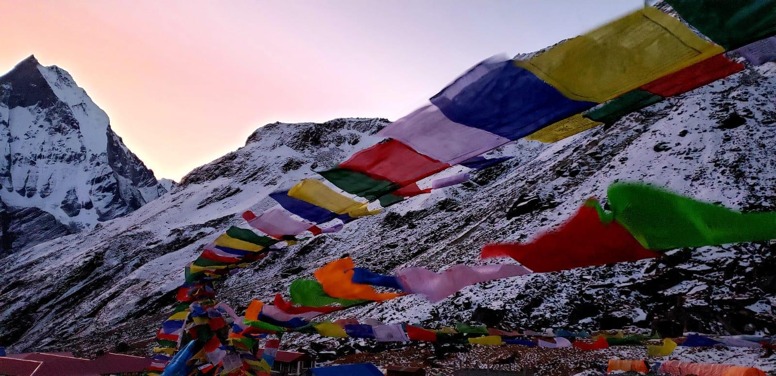
Pangpema Peak: Kanchenjunga North Base Camp Trek

18

Pangpema Peak: Kanchenjunga North Base Camp Trek is a great trekking region in Nepal. The mountain is also often referred to as the “queen of mountains.” The Kanchenjunga region trek will undoubtedly astonish you with its undiscovered and rustic beauty, especially if you have always yearned to see Nepal’s off-beat places. The area has a variety of natural zones, from glacier wildness to subtropical areas. However, the impressive Kanchenjunga glacier is this region’s major draw.

Kanchenjunga base camp trekking isn’t quite frequently visited by foreign travelers and is wrapped in mystery with extremely difficult mountain trailsย and lush rhododendron woods. Aside from stunning snow-capped mountain peaks, the Kanchenjunga North Base Camp treks also provide panoramas of subtropical lowlands, rhododendron and alpine forests, and breathtaking glaciers. Due to the difficulty of the trip, it is advised that only individuals with previous trekking experience and excellent physical fitness levels attempt it.

The actual north face base camp is located at Pangpema (5,100), which is reached by a steep trail that follows the Kanchenjunga Glacier’s moraine. The base camp, which is situated above the glacier, provides breathtaking views of Yalung Kang, also known as Kanchenjunga West (8,505m), and the north face of Kanchenjunga. To build up endurance for the return trip and enjoy the jaw-dropping views of Mount Kanchenjunga, Janu Himal, and other Himalayan peaks, an additional day is spent here.

Mt Kanchenjungaย is 8,586 meters high and was formerly believed to be the highest peak in the world until 1849; it is the third tallest mountain in the world, trailing only K2 (8,611 meters) and Mount Everest (8,848 meters).

BIRDS AND ANIMALS FOUND IN THIS REGION

A diversity of species, including the elusive snow leopard, the Asian black bear, and theย red panda, are just a few of the more uncommon animals thatย can be found in the region, which is protected by the Kanchenjunga Conservation Area and the Sacred Himalayan Landscape program of the World species Fund.

Birdwatchers may have the opportunity to witness species, including the blood pheasant, snow cock, and golden-breasted fulvetta. The Tibetan Buddhist villages, monasteries, and prayer flags provide a distinctive character to the walk because they are located in the farthest eastern part of Nepal and border Sikkim in India and Tibet.

KANCHENJUNGA TREK HIGHLIGHTS

1 1
Pangpema Peak: Kanchenjunga North Base Camp Trek 4
  • Experience the trek to the third-highest peak in the world’s lap through regions that aren’t often visited.
  • Exceptional views of the Makalu range, the Kanchenjunga massif, and surrounding peaks, including Jannu, Mera, the Twins, and Wedge (Chang Himal).
  • cultures of the high mountains untouched by modernization
  • Wander through high-altitude marshes and alpine meadows.
  • Follow the Tamur and Ghunsa Rivers’ glacier torrents.
  • Trek through the remote settlements of the Kirat and Sherpa tribes.
  • peaceful exploration of the stunning mountain wilderness
  • View of the majestic Kanchenjunga mountains to the north from Pangpema base camp.
  • Difficult passes and high-altitude terrain.
  • A wide range of flora and fauna

HOW TO GET KANCHENJUNGA TREK PERMIT?

You must obtain two permissions for the Kanchenjunga Trek: the Restricted Area Permit (RAP) and the Kanchenjunga Conservation Area Project (KCAP) permit. Trekkers can get their KCAP from the Nepal Tourism Board in Kathmandu, but they can only get their RAP through a legitimate Nepali trekking agency on their behalf.

The second-highest mountain in Nepal and the third-highest mountain in the world, Mt. Kanchenjunga, could be seen up close on the Kanchenjunga trip. It still maintains its status as a restricted region despite having been made accessible to trekkers in the late 1980s. The ideal trekking area is off-the-beaten-pathย since it is still secluded and offers the most extraordinary and stunning unspoiled environment.

PERMIT FEE

1. Kanchenjunga Restricted Area Permit

During the Kanchenjunga trek, trekkers need a Restricted Area Permit (RAP) to visit these areas. Given that the area near the boundary between India and Tibetย has been given a restricted designation. This aids in regulating tourists, safeguarding wildlife, and putting a stop to any unlawful activity in the region.

A government-registered and authorized Nepali trekking agency is the only entity permitted to apply for and get this permission on your behalf. The cost of the Kanchenjunga RAP varies on how long you spend on the trek in the restricted area. Please take note that the prices shown below apply to both foreigners and SAARC nationals.

Restricted Area Permit Cost

$20 per personย perย week for the first four weeks.
$25 per person per week beyond the first four weeks.

2. Kanchenjunga Conservation Area Project

The 2,035 sq. km. Kanchenjunga region is protected and developed as a result of the Kanchenjunga Conservation Area Project (KCAP) authorization. This permit has no expiration date.

Kanchenjunga Conservation Area Project Permit

Citizens of Nepal are charged NPR 100 per person.
The cost for SAARC citizens is NPR 500 per person (about $5).
The cost for foreign nationals is NPR 2000 per person (about $20).

PAPERWORK REQUIRED TO OBTAIN A TREKKING PERMIT

During the application procedure, you will need to present the following paperwork to get a Kanchenjunga Trek permit:

  • Two photographs the size of a passport (for KCAP)
  • A scanned or electronic copy of a passport-size photo must be posted on the Kanchenjunga RAP website.
  • a copy of your current passport
  • Travel insurance documents (including emergency helicopter transport)
  • The passportย must still be valid for at least six months.
  • Having a Nepal tourist visa that is valid after the RAP’s expiration date
  • Other paperwork required by the trekking company to apply for the Kanchenjunga RAP includes trekker and guide group information, guarantee letters, itinerary confirmations, tax clearance certificates, and business licenses.

While all of the above paperwork can seem too much, it will be simpler for your trekking agency will follow up on the necessary paperwork from your end and offer the remaining paperwork on their own.

WHERE TO OBTAIN KANCHENJUNGA TREK

Permit for the Kanchenjunga Conservation Area

The permit can be obtained by trekkers. To apply, go to the Tourism Boardย in Bhrikutimandap, Kathmandu, which is open onย Saturday and Sunday from 9 am to 5 pm, excluding public holidays. You’ll need around an hour to obtain the permission.

Permit for Kanchenjunga Restricted Area

This permit cannot be acquired by trekkers; rather, a legitimate Nepali trekking organization must do it. After you arrive in Kathmandu, they will submit an online application for this permission with all the paperwork you provided and any additional paperwork they created. They will next pick up the permission at the Maitighar, Kathmandu-based office ofย Nepal Immigration’s Trekking Department.

With the assistance of a reputable, experienced Nepalย trekking company, the two permits for the Kanchenjunga Trek may be simply secured. You may get in contact with Treks Planner Nepal to plan and arrange your trip and to assist you in comprehending the permission needs. Our team of professionals will make sure that you quickly and simply get the permissions. Travel to the isolated and lush Kanchenjunga area without any hassles.

KANCHENJUNGA TREK ITINERARY:

Day 1: Arrival in Kathmandu
30 Min Drive to Hotel
Max Altitude: 1350 M

Day 2: Trip preparation
Full Day

Day 3: Fly to Bhadrapur from Kathmandu & Drive to Taplejung
40 Minutes Flight & 8/9 Hours Drive
Max Altitude: 2000 M

Day 4: Trek to Chiruwa
7/8 Hours Walk
Max Altitude: 1290 M

Day 5: Trek to Sermanthang
6/7 Hours Walk
Max Altitude: 2150 M

Day 6: Trek to Amjilosa
5/6Hours Walk
Max Altitude: 2803 M

Day 7: Trek to Gyabla โ€“ Ghunsa
8/9 Hours Walk
Max Altitude: 3550 M

Day 8: Acclimatization day in Ghunsa
Full Day
Max Altitude: 3550 M

Day 9: Trek to Khambachen
5/6 Hours Walk
Max Altitude: 4000 M

Day 10: Acclimatization Day - Optional Side Trip to Janu/Kumbakarna Base Camp)
Full Day
Max Altitude: 4000 M

Day 11: Trek to Lhonak
5 Hours Walk
Max Altitude: 4770 M

Day 12: Trek from Lhonak โ€“ Pangpema (North B.C.) โ€“ Lhonak
7/8 Hours Walk
Max Altitude: 5143 M BC

Day 13: Trek to Khambachen
5 Hours Walk
Max Altitude: 4000 M

Day 14: Trek to Ghunsa โ€“ Further to Phaley
5/6 Hours Walk
Max Altitude: 2900 M

Day 15: Trek to Amjilosa
5 Hours Walk
Max Altitude: 2308 M

Day 16: Trek to Ranipul
3/4 Hours Walk
Max Altitude: 1800 M

Day 17: Drive to Taplejung
6/7 Hours Drive
Max Altitude: 2000 M

Day 18: Drive to Bhadrapur
 8/9 Hours Drive
Max Altitude: 91 M

Day 19: Fly to Kathmandu from Bhadrapur & Transfer to hotel
40 Minutes Flight & Transfer to Hotel
Max Altitude: 1350 M

Day 20: Departure from Kathmandu
30 Min Drive to Airport

FEEL FREE TO REACH OUT!


Trek toย the Everestย Threeย Passes: 7ย Reasons Why

Kongma La Pass

Trek to the Everest Three Passes: 7 Reasons Why you should opt for it. For those seeking a comprehensive trekking experience in the Everest area, the Everest Three Passes Trek offers an outstanding itinerary. One of the toughest and most rewarding trips that can be done in the Himalayas is the Everest Three Passes Trek, which lasts 18 to 20 days. The trekkers may explore the perennially famous Everest Base Camp while also traveling off the beaten road to some of Nepal’s most breathtaking (and sometimes underrated) places.

4
Kongma La Pass

The Cho La (5400 m), the Kongma La (5535 m), and the Renjo La (5360 m) are three of the trek’s three passes as you make your way over the diverse landscape. Gokyo Lakes, traditional settlements, the large Ngozumpa Glacier, and, of course, breathtaking vistas of four of the ten highest mountains in the world, Cho Oyu (8,201 m), Makalu (8,463 m), Lhotse (8,516 m), and Everest (8,850 m), are the sights that await you.

78604554 779948782443904 7759873157787287552 n
Trek toย the Everestย Threeย Passes: 7ย Reasons Why 12

The trek starts with an exhilarating flight to Lukla. From Namche, the trip turns anticlockwise, towards Tengboche. From there, it continues on to Kalapatthar and Everest Base Camp via Kongma-la Pass. The trek continues as you cross Cho-la and Renjo-la passes and ascend to Gokyo-Ri. Experience the monastery life, the old trading route, and the culture, tradition, and way of life of the highland Sherpas.

1. Greater nature, fewer people

55557275 10157124272210522 2399481186121416704 o
Trek toย the Everestย Threeย Passes: 7ย Reasons Why 13

With so many companies offering a regular trek to Everest Base Camp, the popular Everest dream is one that many people may now easily fulfill. 500 people per day may travel to the Base Camp during the peak season. This large and stunning area does, however, nonetheless contain certain areas that are more tranquil and unaltered. After Namche, The Three Passes departs from the conventional and busier Everest Base Camp route and leads you through the spectacular Khumbu Region’s terrain.

2. With Great Challenge Comes a Great Reward.

8
Trek toย the Everestย Threeย Passes: 7ย Reasons Why 14

In addition to being longer, the trip is more challenging than the standard Everest Base Camp route because it entails crossing the three high passes that give it its name: Renjo La, Cho La, and Kongma La, each of which is higher than 5,000 m (16,500 ft). Although the trek includes two days for rest and acclimatization, you’ll still spend most of your days trekking for roughly 5-8 hours each day at high elevations, necessitating a specific level of fitness, willpower, and stamina. Even for seasoned Himalayan trekkers, this path is a real struggle. The Three Passes trek, on the other hand, truly offers the finest of the Khumbu region if you are prepared for the challenge.

3. Thame: A Unique Sherpa Village

The opportunity to see Thame, a typical Sherpa settlement, is one of this trek’s special parts. Thame has a very excellent and deep history for such a tiny community that doesn’t see many visitors.
One of the oldest monasteries in the Khumbu area, acknowledged for its yearly Mani Rimdu celebration, is also located near Thame. There is nowhere else like Thame. It is a community of perseverance, beauty, spirituality, and strength, and visiting it can be a memorable experience.

4. Witness Exceptional Views from the Summit of Gokyo Ri and Kala Patthar

Gokyo Ri feb
Trek toย the Everestย Threeย Passes: 7ย Reasons Why 15

On this trek, you’ll get the chance to climb two summits, Kala Patthar (5,545 m) and Gokyo Ri (5,357 m), from where you’ll get the most breathtaking views of the Himalayas’ greatest peaks.

The Everest Base Camp trek’s highest point is Kala Patthar, which means “black rock” and is the tallest of the two summits. It is the highest point in the Himalayas that can be reached without the need for technical climbing skills, which makes it the most popular mountain for trekking. It also has stunning vistas. Since Base Camp can’t view the Everest summit, most trekkers choose to hike Kala Patthar in order to see it. In addition to spectacular views of the neighboring peaks Nuptse Nup, Changtse, and Lhotse, Kala Patthar offers the “official” and boastful up-close and personal perspective of Everest.

Gokyo Ri is less visited than Kala Patthar, although having attractions that may compete with the more well-known summit. Many people consider the view from Gokyo Ri to be even greater than the one you get from Kala Patthar, despite the fact that the mountain vistas are farther away. Four of the 14 highest peaks in the world, totaling more than 8,000 meters, are visible from there: Everest (8850 m), Lhotse (8501 m), Makalu (8475 m), Cho Oyu (8153 m), and more.

5. Witness the Ngozumpa glacier

The Khumbu Glacier at the foot of Everest is what most people picture, but the Ngozumpa Glacier in the Gokyo Valley is really bigger and more magnificent. The glacier itself, which flows from Cho Oyu’s face, is the longest in the Himalayas and extends 36 kilometers (22 miles) into the Gokyo Valley. In recent years, the glacier’s lower end has been melting, and multiple lakes have emerged on the glacier’s surface. The ice is still there behind the heavy layer of moraine material (rocks) that covers much of the bottom portion of the glacier.

6. Cross three challenging 5,000 m passes: Renjo La, Cho La, and Kongma La

The Everest or Khumbu area of eastern Nepal is where you’ll undertake the Everest Three Passes Trek. There are three high passes in the Everest area to cross on the way to Gokyo and Everest Base Camp: Renjo La (5360m), Cho La (5420m), and Kongma La (5535m). All three crossings offer stunning views of the Khumbu region’s many mountain peaks, including Everest (8848.86m), Cho Oyu (8201m), Makalu (8481m), Pumori (7161m), Ama Dablam (6856m), Lhotse (8516m), and Nuptse (7861m).

The trekkers get a glimpse of Buddhism in the Himalayas by passing through a number of historic monasteries along the way. The trekkers reach the beautiful Gokyo Lakes and Ngozumpa Glacier, the biggest glacier in the Khumbu area, after passing through the first pass, Renjo La (5360m). The route over the second pass, Cho La (5420m), leads to Kalapatthar (5550m) and Everest Base Camp (5364m), both of which provide breathtaking views of the spectacular Khumbu Himalayas and the Khumbu Icefall. The trip back to Namche, Lukla, and a flight back to Kathmandu begins with the ascent of the 5535-meter Khongma La Pass. The three passes trip is the ideal way to see both breathtaking natural beauty and profound cross-cultural discovery.

7. Make A Circuit To Discover More

Since it traverses the Everest region, The Three Passes, and Everest Base Camp is considered the most comprehensive trek in Nepal. Travelers who undertake the standard Everest Base Camp trip follow the same route both up and down. The Three Passes and Everest Base Camp journey, however, is completed in a loop. As a result, you spend considerably less time going back and repeating yourself and much more time admiring the Himalayas’ beautiful scenery.

You can go either clockwise or counterclockwise on the trek. However, it is important to note that when you go counterclockwise, going up northeast to Everest Base Camp and Kala Patthar first before taking Cho La Pass to Gokyo and snaking back down through Renjo La and Thame to Namche Bazar, the scenery gets progressively better and acclimatization is easier, it is also possible to complete the trek faster. But ultimately, everything comes down to personal choice. The Everest Base Camp is the first stop on our typical route since it has a simpler acclimatization pattern.

Everest Three Passes Trek Itinerary – Anticlock Wise

Outline Itinerary:

Day 01: Fly to Lukla (Altitude: 2860 m), trek to Phakding
Altitude: 2610 m/8613 ft. | Flight: 30 minutes | Trek: 3/4 hrs.

Day 02: Trek to Namche
Altitude; 3440 m/11352 ft. | Trek: 5/6 hrs. 

Day 03: Rest day for acclimatization
Altitude; 3440 m/11352 ft. 

Day 04: Trek to Tengboche
Altitude: 3860 m/ 12738 ft. | Trek: 5/6 hrs. 

Day 05: Trek to Dingboche
Altitude: 4410 m/14553 ft. | Trek: 5/6 hrs.

Day 06: Trek to Chhukung
Altitude: 4750 m/15675 ft. | Trek: 5/6 hrs. 

Day 07: Rest Day
Altitude: 4750 m/15675 ft. 

Day 08: Trek to Lobuche via Kongma-la pass
Altitude: Kongma-la: 5535 m/18265 ft. Lobuche: 4910 m/16203 ft. | Trek: 6/7 hrs. 

Day 09: Trek to Everest Base Camp
Altitude: 5357m/17678 ft | back to Gorekshep - Altitude: 5140 m/16960 ft. | Trek: 6/7 hrs.

Day 10: Trek to Kalapatthar back to Dzongla
Altitude: Kalapatthar: 5550 m/18315 ft. Dzongla: 4830 m/15939 ft. | Trek: 6/7 hrs.

Day 11: Trek to Tragnang via Cho-la pass
Altitude: Cho-la pass: 5330 m/17589 ft. | Tragnang: 4700 m/15510 ft. | Trek: 5/6 hrs.

Day 12: Trek to Gokyo
Altitude: 4790 m/15805 ft. Trek: 4/5 hrs.

Day 13: Gokyo Valley: Acclimatization Day - Optional Hike to 5th Lake
Altitude: 5000 m/33000 ft. | Trek: 5/6 hrs. 

Day 14: Trek to Lumde via Renjo-La Pass
Altitude: 5360 m/17685 ft. | Lumde - Altitude: 4380 m/14455 ft. | Trek: 5/6 hrs. 

Day 15: Trek to Thame
Altitude: 3800 m/12540 ft. | Trek: 4/5 hrs. 

Day 16: Trek to Namche
Altitude: 3440 m/11352 ft. | Trek: 4/5 hrs. 

Day 17: Trek to Lukla
Altitude: 2840/ 9372 ft. | Trek: 4/5 hrs. 

Day 18: Fly to Kathmandu
Altitude: 1350/4428 ft. | Flight: 30 minutes 

Everest Three Passes Trek Itinerary – Counter clock Wise

Outline Itinerary:

Day 01:Fly to Lukla, trek to Phakding
Altitude: 2840/ 9372 ft | Phakding: 2610 m/8613 ft. | Flight: 30 minutes | Trek: 3/4 hrs.

Day 02 Trek to Namche
Altitude | 3440 m/11352 ft | Trek: 5/6 hrs

Day 03: Hike to Hotel Everest View
Altitude: 3,790 m| Trek: 1 hr

Day 04: Trek Namche Bazaar to Tengboche
Altitude: 3860 m | Trek: 5/6 hrs

Day 05: Trek to Dingboche
Altitude: 4410 m | Trek: 5/6 hrs.

Day 06: Rest day for acclimatization | Nangkartshang Peak
Altitude: 4410 m | Hike to Nangkartshang Peak - Altitude: 5,083 m | Trek: 4 hours.

Day 07: Trek to Chhukung
Altitude: 4750 m/15675 ft. | Trek: 5/6 hrs.

Day 08: Chukkung Ri

Day 09: Trek to Lobuche via Kongma-la pass 
Altitude: Kongma-la: 5535 m/18265 ft. | Trek: 6/7 hrs.

Day 10: Trek to Everest Base Camp
Altitude: 5357m, back to Gorakshep - Altitude: 5140 m | Trek: 6/7 hrs.

Day 11: Excursion to Kalapatthar and back to Gorekshep to Dzongla 
Altitude: Kalapatthar: 5550 m/18315 ft. | Gorakshep: 5140 m/16960 ft. | Dzongla: 4830 m/15939 ft. | Trek: 6/7 hrs.

Day 12: Trek to Gokyo via Cho La pass
Altitude: Cho-la pass: 5330 m/17589 ft. | Gokyo: 4,800 m/15840 ft. | Trek: 6/7 hrs.

Day 13: Morning Excursion to Gokyo Ri
Altitude: 5483m/18094 ft. | Trek: 4/5 hrs.

Day 14: Gokyo Lakes IV & V

Day 15: Trek to Lungde via Renjo-la Pass 
Altitude: 5360 m/17685 ft. | Trek: 6/7 hours

Day 16: Trek to Namche Bazaar 
Altitude: 3,441 m | Trek: 7 hours 

Day 17: Trek to Lukla
Altitude: 2,804 m | Trek: 6 hours

Day 18: Fly to Kathmandu
Altitude: 1350/4428 ft. | Flight: 30 minutes

Mardi Himal Trek Vs Langtang Valley Trek

Langtang Trek

We certainly hope that our thorough analysis of the Mardi Himal Trek vs. Langtang Valley Trek will help you in picking the ideal trekking route.

ABOUT MARDI HIMAL TREK

11
Mardi Himal

Trekkers can take in a breathtaking view of the spectacular Annapurna massif, Dhaulagiri, Machhapuchhre, and Manaslu from the base camp of Mardi Himal, which is reached by the Mardi Himal trekking path at a height of 4500 meters. Additionally, it offers a stunning viewpoint of the Annapurna Sanctuary’s blue glaciers. In Nepal’s Annapurna area, the position is to the east of the Annapurna Base Camp. This off-the-beaten-path route leads hikers up to the base of Mardi Himal via unspoiled tiny Tamang and Gurung towns, a grove of rhododendron and juniper, and away from more congested trails.

ABOUT LANGTANG VALLEY TREK

2
Mardi Himal Trek Vs Langtang Valley Trek 22

With more than 70 glaciers of varying sizes, Himal mountain ranges, and high altitude lakes like Parvati Kund, Bhairavkunda, Dudhkunda, and even the most famous Gosainkunda with an area of 13,8 ha, surface elevation of 14,370 ft, and water volume of 1,472,000 m3, Langtang is a region in the Himalayas of Nepal that borders Tibet. The skills, attire, traditionally built stone home, and exquisitely carved wooden entryway of the local population demonstrate their rich Himalayan culture and heritage. The majority of the people in these communities are of Tibetan and Tamang ethnicity.

Chimse Danda, a steep mountain range to the south, is traversed by the passes of Ganja La (5,122 m), Jugal Himal, and Dorje Lakpa (6,989 m). The Langtang Khola (river) is fed by glaciers that formed on the slopes of Dorje Lakpa, Langtang Lirung, and other peaks. Before pouring in a ridiculing torrent into the Bhote Koshi River from a long, tight gorge at the western end of the valley, the Langtang River travels through the high, Langtang valley. The Langtang Khola, a major part of the Trisuli Ganga, runs east to west over the grain of the nation, while several large rivers originate in Tibet and travel south, slicing through the Himalayan mountain range.

LANGTANG TREK HIGHLIGHTS:

IMG 5e2e1c524b4f6329af983125d6a8ada9 V
Mardi Himal Trek Vs Langtang Valley Trek 23
  1. Explore Langtang National Park, the first national park in the Himalayas, which was founded in 1976 and has a total land area of 1,710 km2.
  2. Witness snow-capped peaks like Yala Peak (5700m), Gang Chhenpo (6388m), Dorji Lhakpa (6966m), and Langtang Lirung (7245m).
  3. Discover more than 70 glaciers and the stunning lakes of the Langtang Valley, including Gosainkunda (4,380 m), Parvatikunda, Bhairavkunda, and Dudhkunda.
  4. An overviewย of the Tamang and Tibetan languages, together with the complex way of life of those who are still in growth, unquestionably establishes a hard and rigid touch throughout Langtang.
  5. Possibility of trekking to a number of stunning snowcapped mountains and valleys, including Ganesh Himal, Tsho Rolpa Lake Trek, Tashi Lapcha Pass Trek, Gosainkunda Lake Trek, Langtang Valley Trek, and Helambu Trek

MARDI HIMAL TREK HIGHLIGHTS

9 1
Mardi Himal Trek Vs Langtang Valley Trek 24
  1. Stunning dawn and sunset views from many different places
  2. Beautiful scenery, little villages, farms, rice terraces, breathtaking hills and mountains, and vibrant rhododendron woods in the spring
  3. Magnificent views of the Annapurna South (7,010 m), Mt. Hiunchuli (6,441 m), and Machhapuchhre Himal (6,993 m).
  4. Beautiful homestays and friendly local hospitality
  5. Possibility of visiting Mardi Himal High Camp and Mardi Himal Base Camp regional diversity in plants and animals
  6. The social culture and way of life of the Magar and Gurung ethnic groups

WHAT TO EXPECT ON THE TREK?

LANGTANG

Different kinds of Rhododendrons, an extensive Bamboo forest, stunning scenery, a range of snow-capped mountains, and a diversity of fauna, including Red Pandas, are all highlights of this region’s excursion. Following a local path upstream along the Bhote Koshi River, passing past ethnic Tamang settlements, a verdant forest, and the vast Langtang valley with magnificent mountain views on all sides. The route to the Shin Gompa can be taken again, leading to a high plateau near the revered Lake Gosaikunda. The region gives morning views across the many sparkling lakes of this holy site.

MARDI HIMAL

This location is regarded as one of the undiscovered Annapurna’s secret beauties, and the trekking trail is said to be an unbeatable route. It is ideal to experience the splendor of isolated, perpetually snow-capped peaks as well as the enormous possibility ofย amazing cultural exchange and the wonder of Machhapuchhare Base Camp. The colorful and intriguing path meanders through lush valleys, alpine meadows, lichen-covered forests, numerous streams, and waterfalls while offering breathtaking mountain vistas that reflect on the surrounding skyline.

TREKKING DIFFICULTY IN THIS REGION?

LANGTANG TREK DIFFICULTY

It is regarded as a moderate trek that doesn’t require any prior experience, with a path that includes uphill and downhill approaches as well as some steep sections. The difficulty of the walk also depends on the time of year. Trekking in the area is most convenient in the spring (March through May) and fall (September through November) months. You can tackle the Langtang trek difficulties even though the trekking route has rough terrain and rocky pathways if you are mentally and physically prepared and have the right gear packed. And if you’re a beginner hiker, you can choose the finest hiking season to ease the difficulty of the hike.

MARDI HIMAL TREK DIFFICULTY

As it isย a teahouse trek, this route is rather simple. The majority of trekkers have regarded it as an easy trek due to its short length and lack of tough terrain. However, because of the strenuous lengthy hikes and several steep climbs, novice hikers have also ranked it as a medium-difficult trip. On the Mardi Himal foothills, it takes around 5 to 6 hours of walking, with breaks for resting in between. Despite the trip being uphill, the altitude might not be too much of an issue. That’s because there have beenย rest times planned correctly.

HOW MUCH BUDGET IS NEEDED?

LANGTANG AND MARDI HIMAL TREK BUDGET

The estimated cost depends on the type of trek being undertaken and the spendthrift factor. But generally speaking, prices range from about US $500 to US $1500. It also depends on how much one wants to treat themselves to different extra indulgences.

ARE PERMITS REQUIRED FOR THIS TREK?

Both trekking regions need a permit. Before beginning a trek in the Langtang and Mardi trek areas, you must have a permit. You will need to show them at several checkpoints along the way. It is a good idea to get permission before the trip begins. In any case, you may get a trekking permit at the trailhead if you are unable to do so in Kathmandu.

LANGTANG REGION PERMITS:

  1. TIMS card Entry Permit
  2. Langtang National Park Entry Permit

MARDI TREK PERMIT:

  1. Annapurna Conservation Area Permit (ACAP)
  2. TIMS card

WHY ARE PERMITS REQUIRED?

The Langtang and Annapurna Region Trekking Permits are significant in their own right.
By preserving the trekker’s history inside the National Park, the permit contributes to the preservation of the trekkers’ safety and security. The information may then be gathered to assist the authorities in helping you in the event of any crises like earthquakes, landslides, etc. These permits assist in maintaining rules and regulations as well.

HOW MUCH GUIDE AND PORTER TIPPED IN NEPAL?

Tipping is anticipated because the guide or porter depends heavily on tips for income or savings. Tipping is depending on how well your hiking team performed. It all depends on how happy you were with the hospitality shown to you and the services that were rendered to you, so if you are, feel free to tip accordingly. Typically, 12โ€“15% of the total trip cost is regarded as the optimum tip range. Depending on how satisfied you are with the guide and porter, you can divide the cost between them.

TREKKING ITINERARY

LANGTANG VALLEY TREKKING ITINERARY

Day 01: Drive to Syabrubesi from Kathmandu
Altitude: 1,420m/4,658ft | Drive: 8/9 hrs.

Day 02: Trek Syabrubesi to Lama Hotel
Altitude: 2340m/7,675ft. | Trek: 5-6 hrs.

Day 03: Lama Hotel to Langtang Village
Altitude: 3,480m/11,415ft. | Trek: 5-6 hrs.

Day 04: Langtang village to Kyanjing Gompa
Altitude: 3,870m/12,697ft. | Trek: 3-4 hrs.

Day 05: Exploring day at Kyanjin Gompa
Altitude: 3,870m/12,697ft. | Trek: 3-4 hrs.

Day 06: Kyanjin Gumpa to Lama Hotel
Altitude: 2340m/7,675ft. | Trek: 6-7 hrs.

Day 07: Lama Hotel to Thulo Syabru Village
Altitude: 1,900m/6,232ft. | Trek: 5-6 hrs.

Day 08: Thulo Syabru to Dhunche
Altitude: 1650m/5,412ft. | Trek: 4-5 hrs.

Day 09: Drive back to Kathmandu
Altitude: 1350/4428 ft.

MARDI HIMAL TREKKING ITINERARY

Day 01: Drive or Fly to Pokhara
Altitude: 850m | Drive: 6/7hrs | Flight: 25 Min

Day 02: Pokhara to Phedi drive and Trek to Pothana
Altitude: 1970m | Drive: 40min | Trek: 5 hours

Day 03: Pothana to Forest Camp
Altitude: 2550m | Trek: 7 hours

Day 04: Forest Camp to High Camp
Altitude: 3580 m | Trek: 6 hours

Day 05: High Camp to Mardi Himal Base Camp and back to High Camp
Altitude:4500 m | Trek: 6/7hrs

Day 06: High Camp to Siding Village
Altitude: 1850m | Trek: 7 hours

Day 07: Trek to Lumre and drive to Pokhara
Trek: 3 hours | Drive: 2 hours

Day 08: Drive or Fly from Pokhara to Kathmandu.

Nepal forbids foreigners from trekking without licensed guides.

Trekking in Ne[al

Foreign nationals can now no longer trek alone in Nepal without a certified trekking guide, according to a new government regulation. This implies that you must, by law, hire a certified trekking guide if you wish to go trekking in Nepal.

The new rule will go into effect on April 1, 2023, according to Mani Raj Lamichhane, Director of the Nepal Tourism Board. He said the choice had been taken for the tourists’ security and benefit.

The new regulation is anticipated to reduce the likelihood of missing tourists while enhancing the experience of both trekkers and guides. Let’s now briefly examine the benefits of hiring trekking guides in order to better understand how the new rule will help tourists.

With this decision, travelers will no longer be able to obtain a TIMS card for trekking in Nepal without a licensed guide. A TIMS card is an essential hiking permit, which is compulsory for trekking in Nepal. This implies that travelers must arrange their treks through a registered trekking operator, which will handle the TIMS card and other required permissions on their behalf.

The importance of hiring a certified trekking guide in Nepal

The advantages of hiring guides for trekking outweigh the disadvantages by a significant margin. The following are some benefits of hiring a trekking guide:

Safety: Hiring a trekking guide makes sure you stay safe while traveling. They will lead you through the trails and can also offer emergency medical assistance.
Navigation: There is no chance of getting lost in the bush because they will show you how to navigate the trails.
Local Knowledge: The guides have a depth of local expertise. They can tell you about the traditions, culture, and way of life in the area.

Efficiency: By hiring a guide, you may make the trek easier and more convenient for yourself. You may simply enjoy the journey while the guides do the rest.
Customization: You can tailor your trek with the assistance of the guides. They care about your safety while also being able to suggest trails and locations.

Choosing the ideal tour operator in Nepal

There are a few things you should think about before choosing to hire a guide from any company. The following are some guidelines for choosing the best leading travel company for you:

  1. Seek an organization having leading guidingย experience.
  2. Verify the legitimacy of the business, including its registration and ownership of the required licenses.
  3. Check out the feedback left by former clients on different websites.
  4. Ask anyone who has gone trekking in Nepal for recommendations.
  5. Choose a company that will respond to your queries and concerns at all times. It guarantees that they genuinely care about you and that your hiking adventures are trouble-free.

Essential Equipment to Pack for Peak Climbing in Nepal

Trekking Gears

Essential Equipment to Pack for Peak Climbing in Nepal. Every mountaineering adventure, whether technical or not, requires a range of climbing equipment that serves as a life support system to ensure a smooth ascent. Check out the list of essential equipment to pack for peak climbing in Nepal. We have carefully prepared a packing list to eliminate any doubt about what to pack for climbing in Nepal. This list is meant to serve as a general guide for all trekkers, including climbers. Your personal preferences and sense of judgment will also factor into your ultimate packing list for climbing in Nepal.ย 

Your personal belongings can only weigh a maximum of 15 kilograms per porter, which also happens to be the limit for all domestic flights in Nepal. The weight limit can be exceeded to some extent because you will have gear and equipment. If your luggage is significantly heavier than the allowed weight, be prepared to pay the additional fee. It would cost $ 1 to $ 2 per kg.

You need to arrange your trekking gear carefully so that you are comfortable at higher altitudes while trekking in the Himalayas of Nepal. Keep in mind that carrying extra baggage will probably be difficult for you and your support crew. Our mantra is “Pack light, but pack smart.” This will help you to travel comfortably while focusing all of your efforts and enthusiasm on exploring the beauty of the Himalayas. Please look over the list of clothing and equipment below.

HEAD AND HAND GEAR

SUN HAT

Any lightweight hat with a good brim or visor.

WOOL OR FLEECE HAT

Should cover your ears. Any brand should be fine.

BALACLAVA

This should fit underneath your wool or fleece hat or be thick enough to be worn alone. (It is best when you are above 5000m, as the winds can be really icy)

NECKBAND

Multi-useโ€”can be worn as a scarf, facemask, and headband to keep your hair out of your face. However, this is Optional

LINER GLOVES

They should be lightweight and synthetic.

WIND STOPPER FLEECE GLOVES

Any brand of Wind stopper fleece

MITTENS W/ PILE LINERS

Esp. for climbing

FOOTWEAR

RUNNING SHOES

These are great for travel and easy walking.

HIKING BOOTS

Boots should be warm and fit well over light and heavy sock combinations. Fit is much more important than brand. (Asolo, Merrill, Scarpa, La Sportiva)

GAITERS

Short, simple gaiters are best, such as Outdoor Research’s Rocky Mountain Low Gaiters, and Gore-Tex gaiters- Recommended for winter trekking & climbing

SPORT SANDALS

For camp in lodges during the evenings.

LIGHTWEIGHT SOCKS

Pairs of synthetic/wool blend (Bridgedale, Patagonia, Wigwam, and Fox River)

HEAVY SOCKS

Pairs synthetic/wool blend (Smartwool, Bridgedale, Wigwam, Fox River)
Clothing:

LIGHTWEIGHT LONG UNDERWEAR TOP/ BOTTOM

(Patagonia-Capilene, REI, and Mountain Equipment Co-op)

MID-WEIGHT LONG UNDERWEAR TOP/ BOTTOM

The Zip T-neck design is good. Light colors are better for tops because they are cooler when hiking in direct sunlight and just as warm as dark colors when worn underneath other layers. (Patagonia, North Face, Mountain Hardware)

BRIEFS

4 pairs of synthetic or cotton. Running shorts also work well for underwear.

CLOTHING

SHORT-SLEEVED SHIRTS

Two synthetics; most nylon running shirts or athletic shirts work well. The shirt material should have vapor-wicking capabilities. (North Face, Patagonia-Capilene)

PAIR OF LONG-SLEEVE SHIRTS

LIGHTWEIGHT WINDPROOF FLEECE

For daytime trekking

JACKET SYNTHETIC OR FLEECE

Synthetic jackets or pullovers are a great alternative to fleece because they are lighter and more compressible. Primaloft type fill or Polartec 100 or 200 fleeces is recommended. (Wild Things Primaloft, Patagonia Puff Jacket)

SYNTHETIC INSULATED PANTS

Primaloft or Polarguard 3D. Full-side zips are recommended. Mountain Hardwear Chugach 3D pants are an example. An acceptable alternative is fleece pants like Polartec 100 or 200, but they are bulkier, heavier, and less versatile.

DOWN INSULATED JACKET

A medium-weight down-fill jacket with a hood. The hood is optional but highly recommended. (Marmot, North Face, Mountain Hardwear, Patagonia)

WATERPROOF BREATHABLE JACKET & PANTS

The jacket must have a hood, and the pants must have full-length side zips. (Arc’Teryx, Marmot, Mountain Equipment Co-op)
Accessories

EXTRAS

SUNGLASSES

For high altitudes. 1 pair of high-quality 100% UV and 100% IR sunglasses with a minimum of 80% light reduction, side shields such as those found on โ€œglacier glassesโ€ are not recommended, but the size and shape of the lens should offer maximum protection from bright light on snow.

One pair of high-quality 100% UV and 100% IR sunglasses, for lower elevations, also as a backup. It is important to have a spare pair of sunglasses.

HEADLAMP W/ SPARE BULB

AA or AAA battery-powered (Petzl or Black Diamond)

SPARE BATTERIES

Bring plenty for reading in tents at night.

BACKPACK

40L or more, internal frame. Top-opening mountaineerโ€™s rucksack style is best.

PACK COVER

Recommended. To protect your gear on rainy days or snowy days etc

SLEEPING BAG

Minimum 10F to the maximum -10F (-12C to -24C) Down 700 fill minimum (Marmot, Mountain Hardwear) – We Provide if you do not have this!

WATER BOTTLES

Two 1-liter, leak-proof wide-mouth (Nalgene or Lexan type bottle)

TREKKING POLES

Recommended. Useful for going up and down trails, Adjustable poles are better for packing. (Leki, Black Diamond)

SWISS ARMY KNIFE

Remember not to leave in carry-on bags for any international or domestic flight.

SUNSCREEN

SPF 30 or higher, non-oily (Dermatone or Terrapin)

LIPSCREEN

SPF 30 or higher (any brand)

TOILETRY KIT

Toothbrush, toothpaste, skin lotion, alcohol-based hand sanitizer, soap, comb/brush, shave kit, (bring travel-size bottles to keep your kit small).

FIRST-AID KIT

Ibuprofen/Aspirin, assorted Band-Aids, moleskin, Neosporin-type suave, a small gauze pad, a roll of adhesive tape, tweezers, and safety pins. Include any prescription travel medications that your doctor may have prescribed (antibiotics, Diamox, sleep aids).

LARGE TRASH COMPACTOR BAGS

For waterproofing some items inside your duffel.

BABY WIPES

EARPLUGS

Very useful for sleeping in tents and lodges.

WATER PURIFICATION TABLETS

Such as Potable Aqua brand iodine tablets are available. You will be given plenty of purified water during your trek, but packing one bottle of backup purification tablets is always a good idea for your travels. They are especially useful in hotels on your way to Nepal. You should not drink untreated tap water anywhere in Asia, and bottled water in some rare cases might not be available.

TRAVEL ITEMS

TREK/ EXPEDITION DUFFEL BAG

Large size with strong zippers. (Wild Things, The North Face, etc.) We provide this.

SMALL TRAVEL BAG

You can also use a second duffel bag. For storing travel clothes and personal items at the hotel in Kathmandu- We could provide you with this

NYLON STUFF SACKS

Two or three, for organizing your gear and clothes. Lighter colors are preferable for easy labeling.

CLOTHES FOR KATHMANDU AND INTERNATIONAL TRAVEL

Two or three changes of comfortable simple travel clothes. Evenings in Kathmandu can be slightly cool in autumn and spring

SMALL PADLOCKS

For locking duffel bag(s)

BOOK(S) / JOURNAL

CAMERA

Digital and/or film camera. Bring plenty of extra batteries, and memory cards for your digital camera. If you recharge your batteries, power will be available in most of the lodges during the trek. Adaptors to fit the outlets in Nepal can be purchased easily in Kathmandu. Digital video camcorders are very useful. They allow you to record sounds and still images as well as video.

CLIMBING EQUIPMENT:

Ice axe
Crampons
Harness
Tape Slings (2)
Screw gate Karabiners (3 locks, 3 unlock)
Descender/Abseil Device
Plastic Mountaineering Boots
Ascender / Jumar
Helmet (optional)

These things are only suggestions; you should pack your clothes and equipment according to your travel history. It’s necessary to keep in mind that effective packing is essential for lowering your load on both domestic and international flights!

Discover the top 6 places to view Mount Everest

Everest

Are you ready to discover the top 6 places to view Mount Everest? Let’s explore more about the best spots to view Mount Everest.

Witnessing Mount Everest is one of the highlights of any trip to Nepal. Not everyone will be able to fulfill their dream of conquering Mount Everest and reaching the top of the world. However, from these spectacular Everest viewpoints, you can still see the magnificent 8,848-meter peak. Apparently, the best place to view Everest is not confined to the Everest base camp trip. Mt. Everest can be seen from many viewpoints in the Khumbu region. Instead, some of these trekking routes that let you experience Nepal’s stunning Himalayas offer the best vistas.

You forget about the rest of the materialistic world when you are greeted with the magnificent Everest. Your soul will be rejuvenated once and for all by the sight of Mount Everest from the top of the world.

1. Kalapatthar (5,555m)

7
Discover the top 6 places to view Mount Everest 36

The highest viewpoint in Nepal, Kala Patthar, is often referred to as Kala Pattar or Kalapatar. The vista from there is the closest one can get to Mount Everest without having to use any mountaineering techniques.

As it takes at least 10 toย 12 days to travel round trip from Lukla Airport to Kala Patthar on the trail that also leads to Everest Base Camp, trekking there requires a significant time commitment. Alternatively, you can also fly in a helicopter from Kathmandu or even Lukla.

Check Itinerary

2. Gokyo Ri (5,357 m/17,575 feet)

5
Discover the top 6 places to view Mount Everest 37

The ascent of Gokyo Ri is a must-do hike from Gokyo. Gokyo Ri, at 5,357 meters (17,575 feet) above sea level, gives yet another viewpoint of Mount Everest. Gokyo Ri is a recently well-liked yet magnificent trekking destination in the Everest region. You will see the Ngozumpa Glacier and the Gokyo Lakes in addition to Everest. The four tallest mountains in the world, Makalu, Cho Oyu, and Lhotse, dominate the skylines in addition to the stunning vista of beautiful Everest. From Gokyo Ri, these peaks all look breathtaking.

Check Itinerary

3. Pikey Peak (4,065m)

IMG 1cf769546b434b47f99f40fd4d31a5d6 V
Discover the top 6 places to view Mount Everest 38

Even more, faraway and comprehensive views of Everest and the surrounding mountains are visible from Pikey Peak. This viewpoint was considered the best in Nepal by Edmund Hillary, a member of the original Mt. Everest ascent crew. In addition to Everest, you can see the 8,000-meter mountains Dhaulagiri and Kanchenjunga in the distance.

A highly suggested off-the-beaten-path trip in the lower Everest Region is a six-day trek to Pikey Peak.

Check Itinerary

4. Farak Ri, Kongde (4,680m/ 15,354 ft.)

It is also known as the Everest Panorama trek, and it is a high-altitude trekking trail intended for seeing Mount Everest from a distance.

Farak Ri is north of the Kongde hamlet, where you can see four of the world’s tallest peaks, and is situated deep within the Sagarmatha National Park. Farak Ri, one of the best locations to view Mount Everest, is also a vantage point from which to observe Mounts Cho-Oyu (8,188 m/26,864 ft.), Makalu (8,485 m/27,838 ft.), and Lhotse (8,516 m/27,940 ft.).

5. Hotel Everest View (3962m/13000ft)

Everest View Hotel
Discover the top 6 places to view Mount Everest 39

The Hotel Everest, known for being the tallest hotel in the world, offers an amazing 360-degree view of Mt. Everest while bringing luxury into the heart of the Himalayas.

One of the best spots to view Mount Everest is from Hotel Everest View, which also offers a relaxing rest area for both trekkers and climbers. In Namche Bazaar, Day 3 of the Everest Base Camp trip is typically set aside as an acclimatization day. Many choose to make the ascent to Hotel Everest View.

And you guessed it right: the Everest mountain range will be clearly visible from the patio area outside the Everet View Hotel. So, after a pleasant two-hour stroll up to the hotel, grab some food and beverages and sit back to take it all in.

Check Itinerary

6. Tengboche Monastery (3870m/2,700 ft)

71757973 2397424687023603 6367924873343270912 o
Discover the top 6 places to view Mount Everest 40

With our list of challenging Everest Viewpoints up to this point, we may have worried you. But this one has lots of advantages, is simple to climb, and has a great view. It is also known as DawaCholing Gompa and is situated in Tengboche, in the Khumjung area, at a height of 3,870 meters. The Khumbu region’s biggest and most significant Gompa is this one. The Tengboche Monastery is located in a hilly area where the ImjaKhola and Dudh Koshi rivers converge. In the year 1916, Lama Gulu constructed the monastery.

The most convenient viewpoint with a great view is Tengboche. The monastery can be reached from Namche by day hike via the closest airport, Lukla. You can continue the Everest journey from Tengboche to Pheriche, the settlement of Gorakshep, and Kala Patthar. From here, you can see Everest, Lhotse, and Ama Dablam in all their breathtaking beauty.

Check Itinerary

Contact Us For More Details:

Top 5 Peak Climbing in Nepal for Novice Climbers

Island Peak

Top 5 Peak Climbing in Nepal for Novice Climbers. Have you hiked all over the world, visited Everest Base Camp, or the Annapurna region, and are now naturally drawn to higher ground? You might want to climb Everest one day, or perhaps all of the highest peaks on the earth, but where do you begin? There may be a thousand other reasons, or you may have the time and want to try mountain climbing.

Nepal is a wonderland for climbers. Whether you’re an expert mountaineer or a novice seeking a mountaineering introduction, the Himalayas of Nepal have it all. Several peaks in Nepal will give you a taste of basic mountaineering.

For physically fit yet inexperienced climbers, Nepal offers easier, as well as stunning, climbs. It’s important to keep in mind that just because a climb in Nepal is classified as “simple,” it doesn’t mean it won’t be difficult. Even if you don’t need technical climbing skills, you’ll need to give yourself enough time to acclimate to the altitude if you want to avoid being sick or exhausted.

Check out the list below:

1. Mera Peak Climbing (6,476 m)

15
Top 5 Peak Climbing in Nepal for Novice Climbers 46

The Mera peak climb provides novice climbers with the ideal introduction to climbing. It is one of Nepal’s simplest peaks to climb, with a trail that winds through pristine Nepali villages that are charming and attractive.

Mera Peak, Nepalโ€™s highest permitted trekking peak, is a peak that every novice climber should attempt at least once. The peak is located in Nepalโ€™s most popular location, the Khumbu region, and rises tall at 6,476 meters. Mera Peak is like a training base before the other tough climbs. The peakโ€™s tough section is ideal for new climbers to improve their skills. Mera Peak is an excellent choice for novices, but it doesnโ€™t have to be restricted to them. Itโ€™s also a great option for experienced climbers seeking a thrilling option in the Himalayas.

CHECK ITINERARY

2. Lobuche Peak Climbing (6,119ย m)

Lobuche Peak Climbing
Top 5 Peak Climbing in Nepal for Novice Climbers 47

Have you ever wanted to climb an Everest region peak? Well, Lobuche West is located near the Khumbu glacier, at the foothills of Mount Everest. It provides you the grandeur of an 8000er with the ease of a 6000er peak and is regarded as one of the simpler mountains in Nepal to climb.

The Lobuche West, however, requires minimal technical expertise to reach its summit despite being a trekking peak. You should prepare well because it is a physically challenging mountain for a beginner.

CHECK ITINERARY

3. Pokalde Peak Climbing (5,806 m)

Pokalde, one of the most popular trekking peaks, is really among the simpler peaks to climb in Nepal. It is known as Dolma-ri and is located around 12 kilometers south of Mount Everest. One of the easiest and shortest climbs in the Everest region is this one. Additionally, Pokalde Mountain has all the majesty and mystique you’d anticipate from an Everest region peak. But its own trek is short and easy for novice climbers. You can never get enough of mountaineering in Nepal if you begin your ascent with Pokalde.

4. Island Peak Climbing (6,160 m)

6
Top 5 Peak Climbing in Nepal for Novice Climbers 48

One of the most well-known trekking peaks in Nepal is Island Peak. One of the first alternatives for beginners who are just starting off mountain climbing is this peak. The difficulty of climbing the Island peak makes it spectacular and thrilling. The remarkable challenge of scaling the enormous Island peak requires careful planning and preparation.

Island Peak is one of Nepal’s most well-known trekking peaks. This peak is one of the initial options for novices who are just getting started with mountain climbing. The difficulty of climbing the Island peak makes it spectacular and thrilling. Planning ahead is essential for the amazing challenge of scaling the massive Island summit.

CHECK ITINERARY

5. Yala Peak Climbing (5,500 m)

The Nepal Mountaineering Association categorizes the Yala summit as a trekking peak. It is a part of the Langtang Himalayas and is located around 51 kilometers (32 miles) north of Kathmandu. It is one of the less difficult peaks in Nepal and is rather simple to climb technically.
In addition, the pristine Langtang valley is breathtakingly beautiful. Yala is one of the best starting peaks for mountaineering in Nepal due to the beauty of the north-central Himalayas.

Contact us for more details

Nar Phu: How To Get Permits to Trek to this Hidden Valley

Nar Phu

Nar Phu: How to Get Permits to Trek to this Hidden Valley. A special permit is required to enter the mystical Nar Phu Valley, which is located in the northern part of the area. Only in 2002 was this untouched valley accessible for trekking. Since then, it has been a restricted area that can only be entered with a special permit. Two Nar Phu Valley Trek permissions are required for prospective hikers: the Nar Phu Valley Restricted Area Permit (RAP) and the Annapurna Conservation Area Project Permit (ACAP).

The designated offices in Kathmandu or Besisahar are where the trekker can apply for and get the ACAP. The Restricted Area Permit (RAP) can only be applied for and obtained on behalf of the trekker by a legitimate Nepali trekking agency.

Travelers might wander to the villages of Nar and Phu to experience the authentic Himalayan wildness. Experiencing historical Tibetan culture, prehistoric trade routes, harsh canyons, rock formations, and one of the high passes are the highlights of this hidden valley.

13
Nar Phu: How To Get Permits to Trek to this Hidden Valley 52

Nar Phu Valley Trekking Permits and Fees:

The government of Nepal has classified the Nar Phu Valley as a restricted area because it is so close to the Tibetan border. Its restricted stance aids in border security, tourism management, and the preservation of historic culture and heritage.

Because of this, all trekkers must have a Restricted Area Permit to enter this area. The appropriate Restricted Area Permit you obtained covers Narpa Rural Municipality and Nasho Rural Municipality because Nar Phu is located in the Manag area.

It costs US$100 for the first 7 days from September to November (autumn) and then US$15 for each subsequent day spent in the restricted area.
Winter, spring, and summer months from December to August: US$ 75 for the first 7 days, plus US$ 15 for each extra day spent in the restricted area.

ย Annapurna Conservation Area Project (ACAP) Cost

Due to the Nar Phu valley trek’s route through the Annapurna conservation area, which stretches above Manang, an Annapurna Conservation Area Project (ACAP) permit is required. The fee is necessary to build trails and save the local animals and flora in the Annapurna region.

The cost for SAARC nationals is Rs. 1000 ($10 approximately) per person.
Other nationals must pay a fee of NRs. 3000 ($30 approximately).

Required paperwork for a trekking permit in Nar Phu Valley

When applying for the Nar Phu Valley trekking permit, you must present the following documents:

  1. 1 or 2 passport-size pictures (for ACAP permit).
  2. One scanned image should be submitted with the Nar Phu Valley RAP online form.
  3. passport photocopies ย (with at least six months validity)
  4. Travel insurance documents (includes helicopter evacuation of up to 6000 m)
  5. Tourist visa for Nepal
  6. Information on the Nar Phu Valley trek route

Where can I get a permit to trek through the Nar Phu Valley?

The information on where to get permits for trekking in the Nar Phu Valley is listed below:
Permits for the Annapurna Conservation Area: Trekkers can obtain this permit in Kathmandu, Pokhara, or Besisahar. Your best possibilities are Kathmandu and Besishar, which you will be passing by.

In Kathmandu, the Nepal Tourism Board is open from 9 a.m. to 5 p.m. on Saturdays and Sundays, excluding public holidays.

Besisahar, Lamjung: The ACAP Entry Permit counter is located at Besisahar and is open every Saturday and Sunday from 10 am to 5 pm, excluding major holidays.

Pokhara: The Nepal Tourism Board’s Lakeside location is open from 10 a.m. to 5 p.m. on Saturday and Sunday, excluding public holidays.

Trekkers can obtain this permit on their own or through an agency in Nepal. However, Trekkers cannot obtain the Nar Phu Valley Restricted Area Permit, hence a legitimate Nepali trekking service should apply for and get the permit on their behalf. The organization will receive all the necessary information and documentation from trekkers and then process an online permit application. The Trekking Department of Nepal Immigration office, located in Kalikasthan, Kathmandu, is where they will pick up the approved permit. Please be aware that neither the Nepal Tourism Board nor TAAN publishes it.

Contact Us for More Details:

How to Get to Lukla Without Taking a Flight?

Lukla

Like many other travelers who do not like the idea of flying to Lukla, are you wondering how to get to Lukla without taking a flight?

The most reliable way to reach Everest Base Camp is to trek without taking a flight to Lukla (EBC). There are different routes in Nepal to get to Lukla, the gateway to Everest. Most people fly from Kathmandu to Lukla and begin their Everest trip there. However, the weatherย irregularities on the Lukla route frequently cause delays. The Lukla flight has a significant likelihood of being canceled in adverse weather, which is quite stressful for every trekker.

From Kathmandu, it is possible to trek to Lukla or to take a jeep ride for a day to get to the villages of Jiri, Phaplu, or Salleri, from which you can hike to Lukla. However, this is a far less common way of traveling.

Route to Get to Lukla Without Flying

1. Getting to Lukla via Phaplu/Salleri

The Everest Base Camp Trek begins in the remote village of Phaplu in northeastern Nepal. The trek from Phaplu to Lukla is a longer option. It is regarded as beautiful and secure, though. The trip from Kathmandu to Palphu or Salleri, the administrative center of the Solu district, takes nine to ten hours. You’ll have to stay overnight at Salleri and catch another jeep to get to Thame Danda via Kharikhola. The trek will start from Thame Danda and it will take approximately 5 to 6 hours to reach Lukla, which is the usual hiking route to Everest Base Camp.

By skipping a flight to Lukla, you can explore the Himalayas on a more budget-friendly basis this way. For trekkers who want to travel on a budget yet have longer holidays, the EBC route from Salleri is a good option. It is an adventure with less crowded Everest trekking routes.

The bus ride takes you through a stunning landscape, along beautiful river banks, and through residents of many ethnic groups. The road frequently crosses high terrain across passes with stunning alpine views, including Mt. Everest, in the background.

2. Getting to Lukla via Jiri/Shivalaya

Sir Edmund Hillary and Tenzing Norgay chose a well-known mountain trail in Nepal’s Khumbu region as an alternate route to reach Lukla from Jiri. It is a popular option for anyone who prefers to take a lengthy, thrilling, and more rewarding journey to the Everest Base Camp.

Start the trek by taking a thrilling bus to the lovely Jiri village instead of taking a flight to Lukla. After that, the trekking route descends through the mali danda in order to reach Shivalaya Pass Deurali.

Then, after traveling through rhododendron trees and Sherpa communities, we continue through Lamjura to Junbeshi. Stunning panoramic views of Everest, Kantega, Thamserku, Mera Peak, and other mountains can be seen on the drive to Nunthala, which is the next stop. From Nunthala, ascend via Sherpa and Rai communities to the Dudh Koshi River, then descend gradually to Bupsa. Enjoy the breathtaking environment as you pass through Kharte, descend to Puiyan, and ascend to Chauri Kharka. The gateway to Everest, Namche Bazaar, will be the next destination.

How can I take a Jeep from Kathmandu to Lukla?

There are no jeeps or buses traveling from KTM to Lukla. From Kathmandu, buses and Jeeps run to Salleri/Phaplu and Jiri/Shivalaya. You can reach Lukla after a few days of hiking. It takes slightly more than nine to 10 hours and costs about $20 to USD 25 to ride a public bus/jeep from Kathmandu to Salleri or Jiri. If you want to hire a private jeep then it would cost approximately USD 350. From there, it will take three days to get to the main trail.

3. Getting to Lukla via Helicopter Ride

Lukla 1
How to Get to Lukla Without Taking a Flight? 56

A helicopter ride to Lukla is an amazing experience if money is not an issue. In less than an hour, you can depart from the domestic terminal of Kathmandu Tribhuvan Airport and fly to Lukla. As you go, the hilly, agricultural landscape of Kathmandu ascends to higher altitudes in the cooler, less productive mountain ranges. Experience the aerial beauty of the Everest region by taking a thrilling helicopter ride. A 25 to 40-minuteย helicopter ride gets you from Kathmandu to Lukla. A helicopter might be booked for between $2200 and $3000 USD. With room for up to five people, you can split the cost of hiring a helicopter with your fellow travelers.

Contact Us For More Details:

Everything You Need To Know About Lukla Flight Changes This Season!

CAAN Nepal

Everything You Need To Know About Lukla Flight Changes This Season! It is not as bad as you anticipated. Let’s find out more details about it.

The Civil Aviation Authority of Nepal (CAAN) has issued an official notification stating that all airlines must operate flights to Lukla from Manthali Airport, Ramechhap.

Despite the fact that this reroute may sound like a major catastrophe, driving to Ramechhap actually lowers the probability of flight cancellations.

As everyone is aware, flights to and from Lukla frequently get canceled or delayed. Even though we cannot ignore the role played by the strong wind and fog, the Kathmandu airport’s traffic congestion is a crucial additional factor that has recently worsened matters. In spite of the weather being favorable for flying, we witnessed multiple incidents during the previous season where trekkers were forced to spend several days nesting in the chilly Lukla Airport. Since Ramechhap Airport only operates flights to Lukla, it is a reasonable alternative for getting to Lukla.

Manthali Airport, Ramechhap

At an elevation of 474 meters, Manthali Airport is situated in the Tamakoshi River Valley in Manthali, the administrative center of the Ramechhap District. It lies 132 kilometers (km) east of Kathmandu, and the drive there by car takes 3.5 hours to 4 hours.

It is a small town that typically sees few visitors. As a result, there aren’t many lodging options available, and the quality of the service is low. During the busiest times of the year, it’s possible that Manthali and Ramechhap won’t have any hotels due to the large number of trekkers who will arrive here to catch their flights.

Transportation Options To/From Manthali Airport, Ramechhap

It is quite an experience to travel from Kathmandu to Ramechhap. In exchange for seeing Nepal’s rustic and rural sides, you will bid farewell to the congestion and concrete of Kathmandu. To get to Bhaktapur, the initial stretch is a six-lane highway. The two-lane road progressively ascends past satellite towns after Bhaktapur to the hill station of Dhulikhel. At this point, you switch to the B.P. Koirala Highway from the Arniko Highway. The road also narrows and has numerous hairpin curves at this point. The picturesque hills, farms, and towns more than makeup for it, though. You will also get to take in the beauty of the Sunkoshi and Tamakoshi Rivers throughout the latter half of the ride.

There are many ways to get to Ramechhap, including using a shared vehicle at two in the morning, daytime public and private buses, or renting a car.

1. 2 AM Drive from Kathamndu to Ramechhap in shared jeep/haice

As crazy as it may sound, the most preferred choice for trekkers is to leave Kathmandu for Ramechhap at two in the morning. The reason is straightforward: this arrangement doesn’t require an additional day in your itinerary. And you arrive in Ramechhap by 6:30 am, giving you plenty of time to get some breakfast and board your plane to Lukla.

2. Private Vehicle Drive to Rammechaap Jeep/Car

Renting a car is the most convenient way to go to Ramechhap. It isn’t too expensive, especially if you can split the expense with others. It will cost approximately $80 to $100 for private car hire and $120 to $150 for a private jeep.

3. Local Bus Drive to Ramechhap

If you have an extra day and don’t like the idea of traveling at night, you can depart for Ramechhap the day before your flight via a local share bus or jeep. The regular public buses leave from the Old Bus Park at 6:00 am in the morning. You can also opt for a shared jeep which leaves from Chabahil at 5:00 am in the morning. It costs around $5 to $6.

Advantages of flying to Lukla from Ramechhap

There are a lot of advantages to flying to Lukla from Ramechhap despite the management’s lack of systematic approach and the fact that security checks are still done manually: There is minimal chance of delays or cancellations brought on by air traffic because the airport only serves to operate flights to Lukla. There are more flights on the schedule. Even in the event of poor weather in Lukla, the backlogs are cleared very quickly due to the short flight length.