How to Plan Your Manaslu Circuit Trek: Key Information and Highlights. An intriguing trip across the isolated and breathtaking Himalayan landscapes, the Manaslu trek provides trekkers with a distinctive and less-traveled option to popular routes like Everest or Annapurna. The eighth-highest peak in the world, Mount Manaslu, is encircled by this path, which offers stunning mountain vistas, fascinating cultural experiences in traditional Tibetan settlements, and a variety of habitats.
The trip blends cultural immersion with adventure, from traversing the difficult Larkya La Pass to finding secret monasteries. This blog includes the ideal times to go, necessary permits, must-see places, and helpful advice to help you organize and make the most of your Manaslu Trek. This trip guarantees an amazing Himalayan experience, regardless of your level of trekking expertise.
These include more specialized issues like the level of physical condition needed for the hike, the possibility of altitude sickness and how to avoid it, several trekking routes in the Manaslu region, and the availability of tea shops and accommodation along the way. The best ways to prepare for the weather, which can change dramatically throughout the trek, local traditions and etiquette in the isolated communities, and ways to get to and from the trailheads are other common questions asked by trekkers.
In addition, issues like the expense of hiring a guide or porter, trekking insurance, and the Manaslu region’s environmental conservation measures are frequently brought up. These extra factors provide hikers a more thorough grasp of the trip and guarantee that they are ready for all of the difficulties and perks of the Manaslu Circuit Trek.
1. Teahouses
Teahouses on the Manaslu Trail provide internet and electricity to their wifi for a charge. Along this route, the coverage of the NTC (Nepal Telecom) SIM is superior to that of Ncell. But the higher you go, the weaker the signals are, and you can only send messages with your phone. Internet access is limited to Samagaon. Internet access is available at Dharapani after crossing the Larkya La.
The route has access to electricity. The hamlets at higher elevations rely on solar power or micro-hydroelectric projects for their power supply, while the communities at lower elevations are linked to the national grid. At higher elevations, poor voltage and power outages are to be expected. Those teahouses that rely on solar energy could not have any electricity if the weather stays cloudy. As a result, it is advised that you trek with a power bank or a portable solar power charger. In most cases, teahouses charge $3 or $4 per hour for wifi and electrical device charging.
2. Transportation
The trailhead is reachable by road from Kathmandu. This removes the concern of having to fly across the mountains in a small airplane, which is dangerous, to reach the trailhead. To travel to the trailhead, you can take a shared Jeep, a private cab, or a public bus. It takes around seven or eight hours to drive from Kathmandu to the trail.
3. Food and Water
Simple dishes like momo (dumplings), chowmein (fried noodles), Tibetan bread, Indian flat bread or chappati, bread toast, oatmeal, and the Nepali staple daal-bhaat (rice, lentil soup, vegetable curry, and pickles) are served in teahouses. If you pay more, you could get boiling or hot water. The majority of food products on the trek are costly since they must be carried by mules or porters from cities located far from the trail. You may buy bottles of mineral water at the teahouses. However, the original retail price may be four or five times more than this.
You may bring a reusable water bottle with a filtration device, such as the Steripen, for drinking water. Alternatively, you may purchase some water purification tablets and use them to clean the local water. Direct consumption of water from open sources, such as rivers and streams, is not advised. Make sure your water is adequately filtered before drinking it.
4. Costs and Methods of Payment at Teahouses
The Manaslu Trail is located in a secluded area of the country. Most of the time, when trekking, you will be isolated from contemporary society. There are no large businesses or shops along the way, nor are there any banks or ATMs. You will only be able to spend money on meals, beverages, and snacks at teahouses. To purchase anything on the trail, you must have local cash on hand because teahouses do not take credit cards or international currencies.
Local cash or Nepalese rupee is the only currency accepted at teahouses and shops along the path. Therefore, be sure you withdraw enough local cash from any ATM operated by the local bank (30 to 40 thousand would suffice) before departing Kathmandu. Visa, Mastercard, and American Express cards are often accepted at ATMs in Nepal. You will need local money to pay for hot showers, tipping the porter and guide after the trip, mineral water, charging your electronic equipment (phone, camera batteries, power bank, etc.), and other expenses in addition to buying food and beverages that are not covered by your trekking package.
5. Packing Lists
A detailed list of all the gear and equipment you will need for your journey will be sent to you by the organization you book it with. Remember to bring your paperwork (passport, Nepal visa, permits, etc.) along with weather-appropriate attire and equipment. There are several stores in Kathmandu where you may buy and rent trekking gear. If you are unsure about the quality of the items available in Nepal, you can carry your kit from home.
You will undoubtedly need crampons and gaiters to traverse the snow-covered pass to cross Larkya La. Because the teahouse facilities are sometimes basic and lack indoor plumbing, you should also remember to include a couple of rolls of toilet paper when you prepare for your hike.
6. Insurance for Travel
This hike requires travel insurance. You have to purchase insurance that will pay for rescue and evacuation expenses at high altitudes. You should carefully read the small print before purchasing travel insurance, since some plans may not cover evacuation services or injuries at high altitudes. One that provides coverage for high-altitude rescue and evacuation over 5000 meters is the one you should pick.
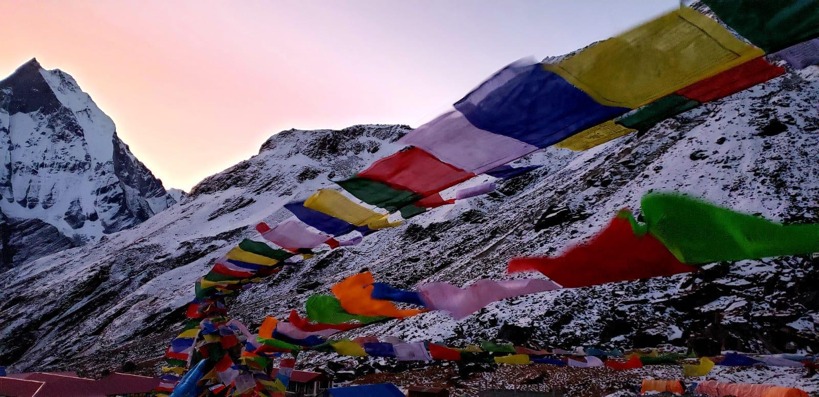
Detours & Interesting Places on the Manaslu Circuit
Tsum Valley
One of the undiscovered treasures of the Nepal Himalaya is Tsum Valley, which may be reached as a side excursion from the Manaslu journey. Tsum remained completely secluded because the Nepali government forbade people from entering in order to preserve the valley’s delicate ecosystem and culture. Only in 2008 was the Tsum Valley opened to tourists. Even the unrestricted flow of Nepalese nationals from other areas into the region used to be restricted.
The atmosphere of Tsum Valley, which is close to Tibet and the Ganesh Himal mountain, seems to be timeless. Old Buddhist monasteries and nunneries that house the wisdom and culture of old Tibetan Buddhism may be found in the Tsum Valley. Because of the valley’s delicate cultural past and its proximity to Tibet, the authorities have chosen to designate the area as a restricted zone in order to prevent outside influences.
There are two distinct areas in the Tsum Valley: Upper Tsum and Lower Tsum. The valley is home to thirty-three communities in all. The valley’s residents speak a dialect known as Tsumke or Tsumba. The Tsum Valley is unique in that all creatures, including birds and insects, are safeguarded and permitted to coexist without human intervention. There are numerous fascinating, valley-specific Buddhist customs observed by the valley’s thirty-three communities. For instance, the culture of’shyagya’.
The “Shyagya” culture is followed by the inhabitants of Tsum. As a Buddhist practice, they have adopted “shyagya,” which translates to “a tradition of non-violence.” According to the “shyagya” culture, it is illegal to hunt and kill wild animals, gather honey, trade animals or their parts, remove trees and burn forests, and catch or kill insects, birds, or animals in the valley. According to the locals, Tsum Valley is a beyul, a hallowed place where all living things are allowed to remain and have been blessed by Guru Rinpoche.
Tsum Valley’s cultural attractions include Mu Gompa, Rachhen Gompa, Piren Phu, and Milarepa Cave. You may incorporate a trip to Tsum Valley into your Manaslu Trek itinerary if you want to see this intriguing location.
Valley of Nubri
The culturally diverse Nubri Valley is traversed by the Manaslu trek. Similar to the Tsum Valley, Tibetan Buddhist culture and customs are well embedded in the Nubri Valley. The Nubri Valley is home to several of the region’s oldest monasteries. The villages of Bhi, Samagaon, Prok, Tsak, Samdo, Lhi, Li, Sho, Shayala, Namrung, Ghap, Shak, and Gyayul are all included in the valley. The Nubri Valley is believed to have formerly been a part of Western Tibet’s Ngari kingdom.
The residents of the Nubri Valley have a distinctive custom of permitting lamas to be married, as they adhere to the Nyingmapa school of Tibetan Buddhism. Married lamas, known as Ngakpas, are permitted to serve as priests in both their houses and the monastery.
One of the oldest and most significant monasteries in the Nubri Valley is the Pungyen Gompa, which is situated at an elevation of 4050 meters. The monastery is situated between Samagaon and Shayla, two Nubri villages. The first people to settle in the Nubri Valley constructed the monastery, which is almost 400 years old. The Nubri name for Mount Manaslu is the source of the monastery’s name, Pungyen. Manaslu, Pungyen, or Kutang are the names given by the people of Nubri Valley.
Residents of the Nubri Valley periodically go to Tibet for supplies and for trade. The peasants find it simpler to obtain goods from the other side of the border because Tibet is closer to their hamlet than Nepal’s towns and cities. Yak caravans are used to carry goods from Tibet to the Nubri Valley.
Rui La, Birendra Taal, and Manaslu Base Camp
The Manaslu Trek allows you to climb to the foot of Mount Manaslu. Manaslu is the eighth-tallest peak in the world and one of the fourteen-eight thousanders, standing at 8,163 meters above sea level. A short ascent from Samagaon’s old town takes you close to Manaslu Base Camp (4,900 m), where you may see the stunning view of the snow-capped summit.
Mount Manaslu, popularly referred to as the “Spirit Mountain,” is revered by the locals as a protective god. Killing or harming any living creature, including insects, birds, or animals, is strictly prohibited among the villages residing at the mountain’s foot since doing so would contaminate this hallowed space and call out the mountain deity’s wrath.
The magnificent alpine lake, Birendra Taal, is encountered on the way to the Manaslu Base Camp. The blue lake is surrounded by snow-capped mountains. It is stunning to see the turquoise lake surrounded by snow-capped mountains.
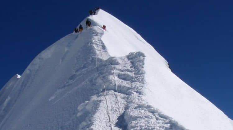
During the busiest climbing season, mountaineering participants trying to reach the top of Mount Manaslu set up tents near the base camp. Even though Mount Manaslu is not as big as Mount Everest, seasoned climbers say it is far harder and complex to reach the summit. From the Manaslu Base Camp, you can also see Himalchuli, Naike Peak, Ganesh Himal, and Shringri Himal, which are all nearby mountains.
Rui La (4998 m), a difficult mountain pass along the Nepal-Tibetan border, is another great destination for day hikers. Samdo hamlet is where the trek to Rui La pass starts. There are no communities for miles along the Rui La Pass track, making it a secluded and desolate route. Yaks and yak herders are the only inhabitants of the desolate mountaintop. Yak caravans are seen moving back and forth from the border region, and Rui La also denotes the commercial route.
A stone at the top of Rui La Pass marks the border between Nepal and the Tibet Autonomous Region of China. Rui La Pass is around a day’s trek from the closest Tibetan settlement. One will arrive at one of Tibet’s roadways after two days of walking.
Annapurna Conservation Area and Manaslu Conservation Area
You will traverse two natural conservation zones along the Manaslu trekking path, which are abundant repositories of Himalayan flora and fauna. The Manaslu Conservation Area is a conservation area that spans 1663 square kilometers. Among other species, the Manaslu Conservation Area safeguards the habitats of the Himalayan tahr, Himalayan marmot, snow leopard, blue sheep, black bear, lynx, and musk deer.
The protected area is home to more than 100 bird species and more than 2,000 plant species. It has six distinct climatic zones (arctic, subarctic, temperate, tropical, and alpine) and eleven different types of wood. Because of the temperature variation, this region is one of the Himalayas’ hotspots for the greatest biodiversity.
The Annapurna Conservation Area Project in the Annapurna Region spans 7629 square kilometers. There are 105 animal species, 518 uncommon bird species, and 1226 wildflower species in the protected area. High on the slopes of the Annapurna Range, this nature conservation area is home to the biggest rhododendron forest in the world.
Conclusion
The Manaslu Trek is the ideal way to combine trekking in the Himalayas with taking in the splendor of culture. You enter a wild setting with lush forests and high mountain passes along the trip. You may go through old villages that are populated by ethnic groups that haven’t interacted with outsiders much. You will surely remember the pristine landscape, vibrant culture, difficult hike, and intriguing encounters with the native mountain people.
The Manaslu Trek is the greatest choice if you want to discover authentic culture and the pristine Himalayan scenery. The hike is less crowded and touristic as well. There are indigenous groups that still live the way their forefathers did. Another incentive to pick this journey is the breathtaking vistas of Himalchuli, Ganesh Himal, Singri Himal, and Manaslu, the eighth-highest peak in the world. We strongly advise you to go on the Manaslu Trek if it is on your bucket list. The information above should be useful to you while organizing a Manaslu Trek in Nepal.
